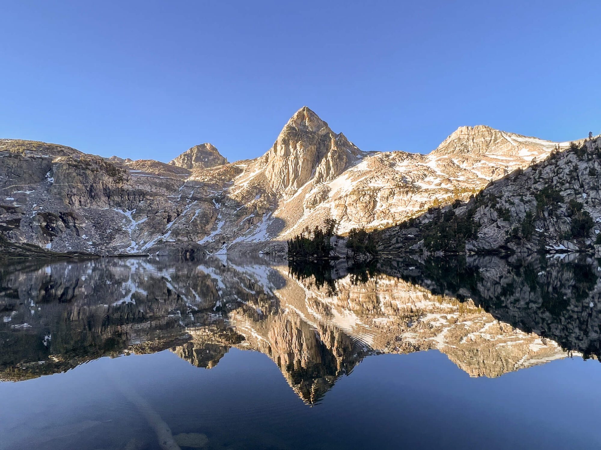
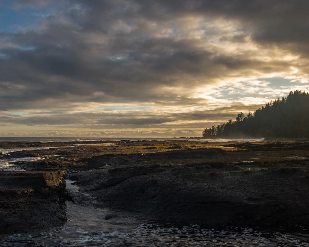
Rae Lakes loop is one of the most coveted backcountry permits in Sequoia & Kings Canyon National parks. For 41 miles (66 KM) you’ll be treated to a seemingly endless supply of the Sierra Nevada superlatives. You’ll hike alongside the roaring South Fork Kings River, experience the cascading torrent of Mist Falls, marvel at the sublime sunrise reflection of the Painted Lady in Rae Lakes, and experience the catharsis of reaching 11,978′ (3651m) Glen Pass.
Rae Lakes Loop can be completed in multiple directions and on a variety of schedules. In this guide, I’ll break down everything you need to know to backpack the Rae Lakes Loop. Here’s what’s in this post:
- Need to know for hiking the Rae Lakes Loop
- Things you’ll love
- Things you won’t love
- What to pack for backpacking Rae Lakes
- How many days does it take to hike the Rae Lakes Loop?
- How do you get a permit?
- Do you need a park entrance pass if you have a backcountry permit for Sequoia and Kings Canyon?
- Which direction should you hike?
- Additional trailhead options
- Can you have campfires?
- Is the hike to Rae Lakes challenging?
- When to backpack Rae Lakes
- How to get there
- Trail Sections
- Campsites on the Rae Lakes Loop
- Itinerary options
- Packing list breakdown
- Final thoughts
** Some of the links in this post are affiliate links. If you click one of the links and make a purchase we’ll earn a small commission at no cost to you. We’re very particular about products and we only recommend products, services, or accommodation we trust and use ourselves.**
Need to know for hiking the Rae Lakes Loop
Days Required: 2-5
Difficulty: Moderate
Distance: 41 miles (66 KM)
Elevation Gain: 7200 ft (2195 M)
Elevation Loss: 7200 ft (2195 M)
Permit Required: Yes, competitive.
Navigation: Easy, trails are well marked.
Water Sources: Plentiful, trail follows reliable creeks and rivers for the duration.
Food Storage: Bear canister required.
Best Campsite walked past or stayed at: Middle Rae Lakes or Upper Rae Lakes.
Things you’ll love about backpacking Rae Lakes
- Sublime Sierra Nevada scenery.
- Well marked and easy to navigate trail
- Loop hike makes transportation a breeze.
- Multiple entry trailheads possible.
- Multiple side trips possible for various itineraries.
- Opportunity to meet other backpackers and thru hikers.
- Plentiful water sources.
Things you won’t love about backpacking Rae Lakes
- Bugs can be viscous.
- Solitude can be hard to find as both the John Muir Trail and Pacific Crest Trail run through the most scenic sections.
- There are bear boxes, yet you need to bring a bulky bear canister regardless.
- Glen Pass can be snow covered until July depending on the snow-pack.
- The sandy soil texture can give you mad blisters. (Bring low gaiters),

What to pack for backpacking Rae Lakes
Here’s a quick summary of what to pack for backpacking Rae Lakes. You’ll find a detailed breakdown of each item at the end of the post with rational, alternatives and quick links to check prices at competing retailers.
Don’t Forget
- Permit
- Bear Canister ** Rangers will check for this
- America the Beautiful Pass (or park entrance pass)
- Travel Insurance with Emergency Medical (if traveling from outside the US)
Essential Items
- Tent
- Backpack
- Sleeping Mat
- Backpacking Pillow
- Sleeping Bag or Quilt
- Water Purification
- Trowel, TP, & Hand Sanitizer
- Swiss Army Knife
- Stove & Fuel Canister
- Lighter & Matches
- Compact Backcountry Cookset & Spork
- Water Bottle or Reservoir
- Extra Water Storage Container (optional)
- First Aid Kit
- Trekking Poles
- Headlamp with red light mode
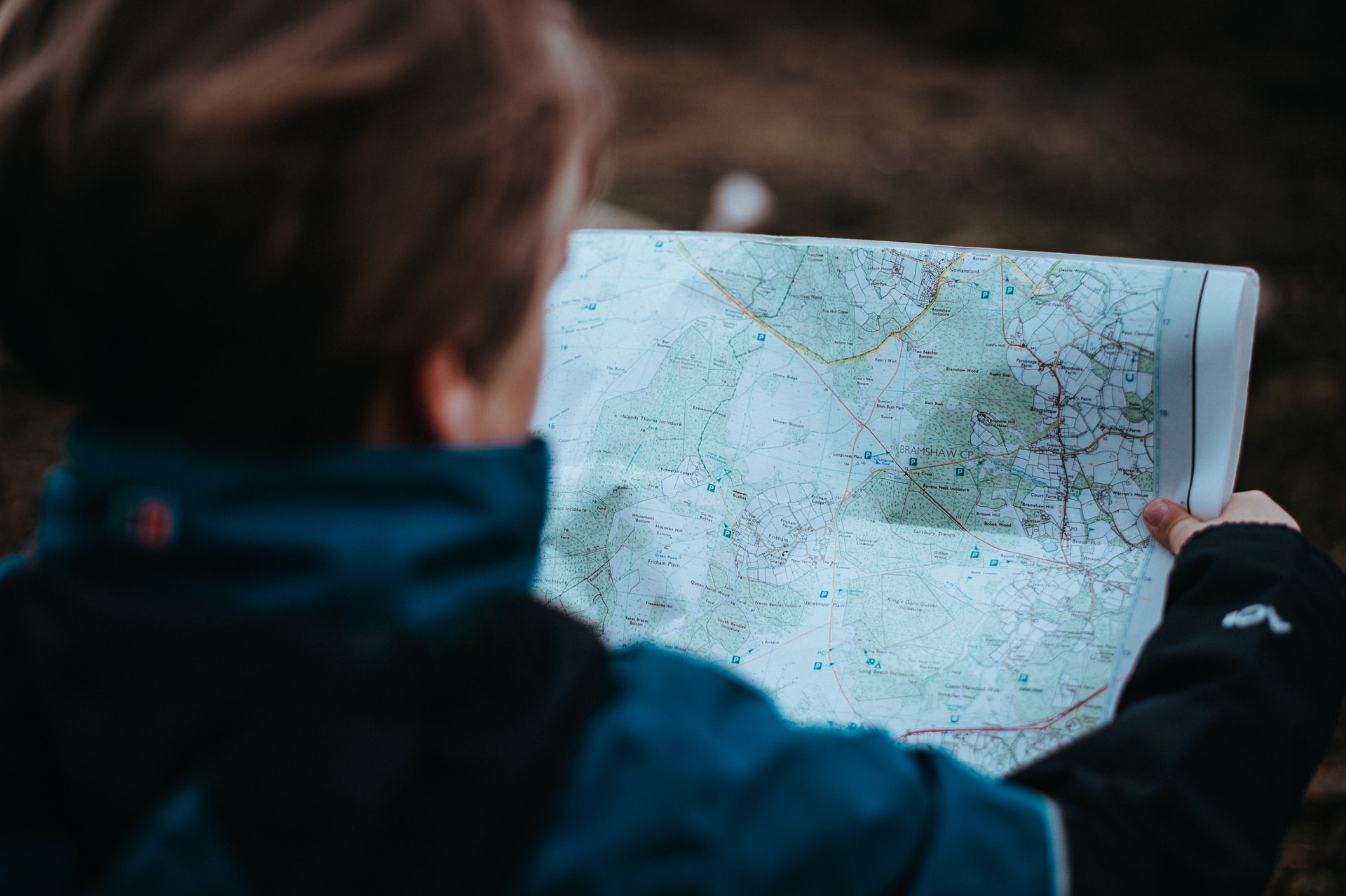
- GPS, Compass & Map
- Battery Back-Up & Charging Cable
Clothing and Accessories
- Shell Jacket
- Puff Jacket
- Sun Hoodie
- Rainpants (optional)
- Convertible Hiking Pants
- Shorts (1 pair)
- Base Layer Top
- Base Layer Bottom
- Underwear (2-3 pair)
- Hiking Socks ( 3 pair)
- Hat & Beanie
- Sunglasses
- Gloves
- Trail Runners or Hiking Boots
- Camp Shoes (optional)
- Low trail running gaiter (optional)
Additional Items
- Microspikes (season dependent)
- Sunscreen & SPF lim balm
- Bug Spray
- Tooth Brush & Toothpaste tabs in ziplock
- Duct Tape (for repairs and blisters)
- Food
Luxury Items (very optional)
How many days does it take to hike the Rae Lakes Loop?
The Rae Lakes Loop typically takes 2 to 5 days to backpack in its entirety. That said, there are many possible side trails for hikers looking to spend more time in the area including Sixty Lakes Basin, Gardiner Basin, and Kearsarge Lakes.
How do you get a permit for the Rae Lakes Loop?
During the quota season (May 26, 2023 – September 23, 2023) there are two ways to secure a permit to backpack the Rae Lakes Loop: through a reservation or walk-up permit. Outside of these dates all permits are self-issued at the nearest visitor center.
The classic Rae Lakes loop starts at Road’s End in King’s Canyon National park and follows either Bubbs Creek (counterclockwise trips) or Woods Creek (clockwise trips).
How to make a reservation
Permits for Rae Lakes Loop can be booked starting 6 months before and up to one week before your intended start date via recreation.gov. Up to 20 people are allowed to enter via reservation daily on both Bubbs Creek Trail or Woods Creek Trail (40 total). Once you’ve secured your reservation, you’ll still have to pick up your permit from Road End Ranger Station starting at 1 pm the day before your hike or as late as 10:00am the day of your hike. If you’re arriving later, contact the wilderness office to let them know to hold your permit or it will be given away.
How to get a walk-up permit
5 people are allowed to enter with walk-up permits daily on either Bubbs or Woods (10 total). These permits can be obtained starting at 1pm the day prior to your hike. If you’re going this route, arrive well before 1pm to snag a spot near the front of the walk-up line. Make sure you have an idea of your itinerary beforehand.
Do you need a park entrance pass if you have a backcountry permit for Sequoia and Kings Canyon?
Yes, you need to purchase an entrance pass to Sequoia and Kings Canyon National Park at the gate or in advance. It’s best to purchase your entrance pass in advance to save time and avoid the line.
Buy an America the Beautiful Annual Pass in advance if you plan on visiting multiple parks or visiting multiple times within a year. Sequoia and Kings Canyon charge $35 per vehicle for a 7 day pass, so it doesn’t take many visits to National Parks or any public lands to pay back the $80 dollar cost.
If this is the only time you’ll be visiting a National Park this year, you can also pre-purchase your 7 day entrance fee at recreation.gov.
Which direction should you hike Rae Lakes?
Rae Lakes Loop can be hiked either clockwise via Woods Creek Trail or counterclockwise on Bubbs Creek Trail. Prior to booking your permit you’ll need to decide on a direction to hike this trip. Here’s more information to help you make your decision:
Clockwise, from the Woods Creek Trail
Starting your hike from Woods Creek Trail results in a more gradual elevation change. This route spreads the 6943 ft (2100 M) climb to Glen Pass out over almost 25 miles, following a steady upward trajectory with a limited number of drastic switchbacks prior to the big push up to Glen Pass
Counterclockwise, starting from Bubbs Creek Trail
Heading counterclockwise from Bubbs Creek is more strenuous, gaining the 6943’ of elevation to Glen Pass over 17 miles. If choosing this direction it doesn’t take long for the thigh burn to begin with a series of switchbacks greeting you within the first several miles and before the first campsite option at Sphinx Junction.
Verdict on direction
In my opinion, the competitive nature of the permit process doesn’t afford the luxury of being choosy. Either way the hike is fantastic.
If I had to choose, I’d start from Woods Creek Trail (clockwise) for the following reasons:
- Your pack is heaviest with food weight at the start of your trip, so more gradual elevation is a perk.
- Afternoon thunderstorms can be common in the summer. A clockwise trip makes it easy to spend a night at Rae Lakes and summit Glen Pass early in the morning before this becomes a factor.
- Rae Lakes close proximity to Glen Pass makes it easier to go clockwise for those looking to include a night at Rae Lakes in their itinerary.
Additional trailhead options for hiking the Rae Lakes loop:
Aside from Bubbs Creek and Woods Creek there are several additional access points for starting the Rae Lakes Loop on the eastern side of the Sierras. Starting from these trailheads will add additional mileage, but may afford you the opportunity to get a permit that might not otherwise be available.
Kearsarge Pass via Onion Valley
The most common alternative trailhead for doing the Rae Lakes Loop, this trail starts from Onion Valley on the eastern side of the Sierras and climbs up and over Kearsarge pass. At 6.5 miles (one-way), it’s a great option and a common resupply trip for thru hikers on the Pacific Crest Trail and the John Muir Trail. This trail offers stunning views of the Kearsarge lakes area on the descent from Kearsarge Pass. Permits for the Rae Lakes Loop starting from Kearsarge Pass must be booked through the Inyo National Forest – Wilderness Permits.
Baxter Pass via Baxter Pass Trailhead
This strenuous 13 mile (one-way) route takes you over Baxter Pass before dropping you down by Dollar lake to the North of Rae Lakes. I have no personal experience hiking over Baxter, but my map marks it as a route (vs. a trail) and the official National Forest description calls it steep and rugged. Buyer beware! Drop me a line in the comments if you’ve done it, would love to hear about it. Starts from the Baxter Pass trailhead and is booked via the Inyo National Forest – Wilderness Permits on Recreation.gov.
Can you have campfires on the Rae Lakes Loop?
Yes, campfires are allowed on sections of the Rae Lakes Loop below 10,000 ft and assuming current fire regulations allow it. The elevation restriction means that fires are never permitted in the section of the trail that starts in the vicinity of Dollar Lake (including Rae Lakes) and ends near lower Vidette Meadow (if traveling clockwise). If you’re making a fire in the allowable areas make sure to follow minimum impact principles, use only existing fire rings, and ensure it’s doused repeatedly, cold to touch, and dead out before hitting the sack. Check with a ranger for all up to date restrictions before heading out.
Is the hike to Rae Lakes challenging?
Like any hike the difficulty of hiking the Rae Lakes Loop is very subjective. Your conditioning, experience, and backpack weight are all major factors. Overall, I’d rate this hike as moderate. It’s well signed and offers multiple campsites to break the mileage up over multiple days. That said, there is significant elevation gain up to the highpoint at Glen Pass and its’ difficulty is compounded by the high elevation that comes with hiking in the Sierra Nevada. Furthermore, the potential for snow travel and river crossings in early season ups the difficulty level.
When to backpack the Rae Lakes Loop
The Rae Lakes Loops can be hiked from early-June through to October. The sun in the altitude of the high sierra is intense during the peak summer months and thunderstorms may pose a risk. Early season travel faces the challenge of snow on Glen Pass and potential for dangerous river crossings. In fall, temperature begin to drop and the potential for snow rises. If going early or late season, contact the wilderness office for questions on conditions. At all times of the year the trail will be heavily trafficked. Aside from Rae lakes being a popular backpacking destination in its own right, trail joins the John Muir Trail and Pacific Crest Trail for about 14 miles from Lower Vidette Meadow to Woods creek bridge.
How to get to the Rae Lakes Loop?
The traditional Rae Lakes Loop starts from Road’s End in Kings Canyon National Park. It can also be started from multiple other trailheads on the eastern side of the Sierras. It’s a loop hike and thus no shuttle is required. Rent a car or drive your own, park at the trailhead and go nothing beats easy logistics! Am I right?
Where to stay before hiking the Rae Lakes Loop
Arriving the day before to pickup your permit or looking to explore before your hike? Staying near to Road’s End in the Cedar Grove area is extremely convenient and there are several accommodation options that can facilitate this. Make sure to book these early as they fill up quickly during the busy summer months.
Camping Options
Several campsites are conveniently situated in the Cedar Grove area making car camping the night before (or after) a snap . Book any of these sites through recreation.gov
Sentinel Campground – I stayed here the night before my hike. It’s a decent site, but many of the sites feel close together.
Similar and next to Sentinel in Cedar Grove are Sheep Creek and Moraine Campground which seem very similar to Sentinel just slightly larger.
If these options are full, consider Azalea Campground, Crystal Springs Campground, or Sunset Campground in Grant Grove about an hours drive from Roads End.
Lodging Options
If you feel like getting off your thermarest and out of the tent for a night here are few great options:
Cedar Grove Lodge – Only 5.9 miles from Road’s End in Kings Canyon this is the most convenient option for spending the night before your hike.
For other options inside Kings Canyon National Park check out John Muir Lodge or Grant Grove Cabins about an hour away from Road’s End in Grant Grove Village.
Trail sections
I’ve described the sections of the Rae Lakes Loop based on my own experience hiking clockwise. If you’re planning a trip the opposite way you’ll have to get creative and try to think backwards.  All distances and elevations are rounded and approximate.
Roads End to Mist Falls
4 Miles (6.5 KM)
850ft (250M) Elevation Gain
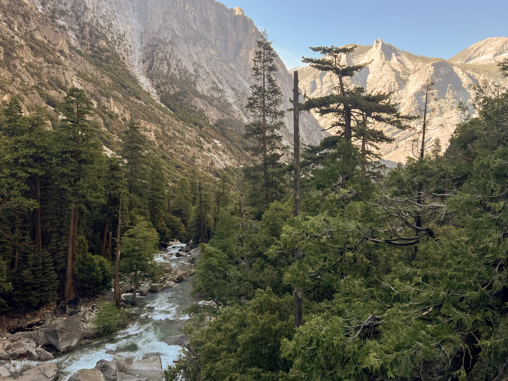
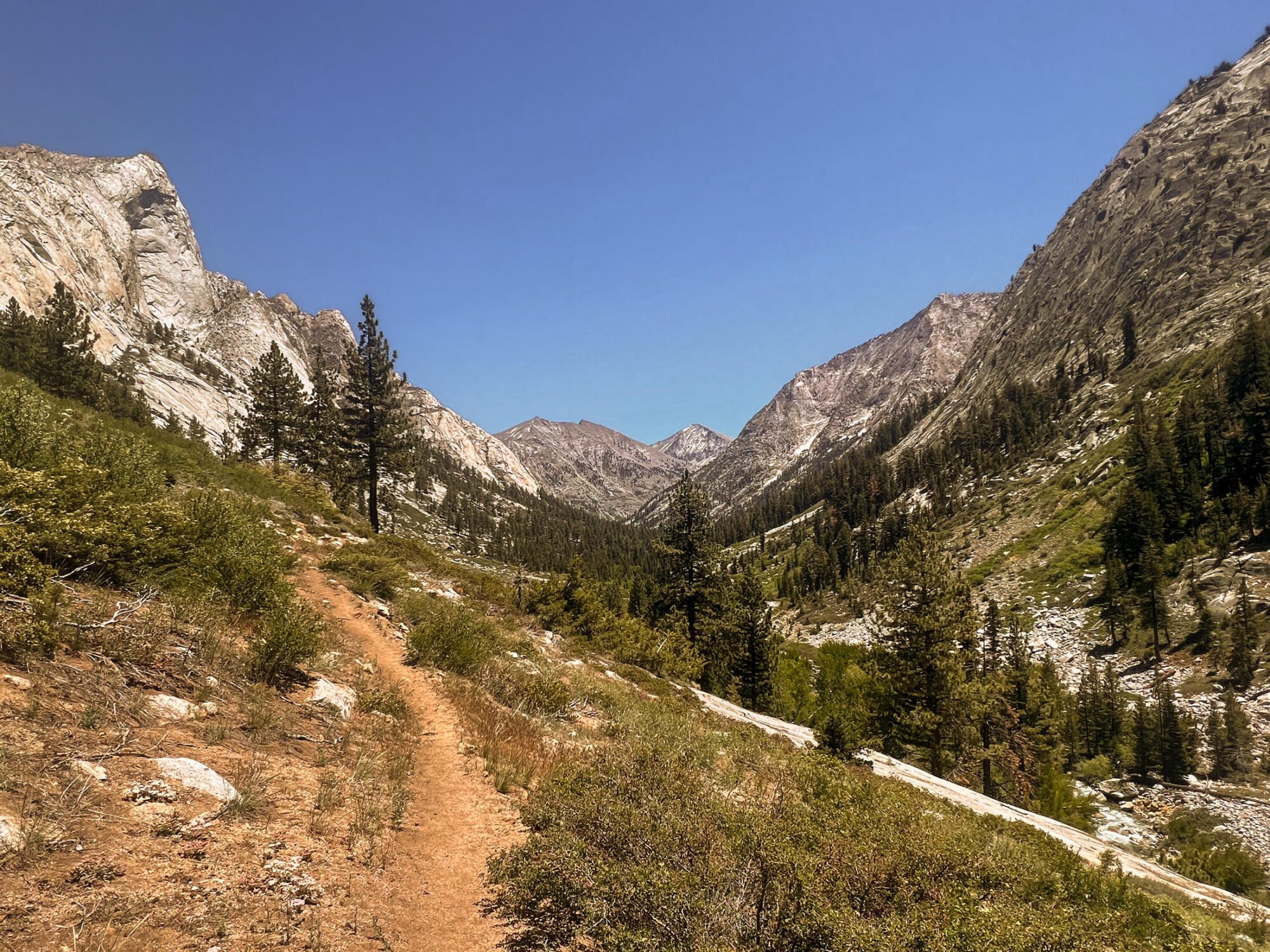
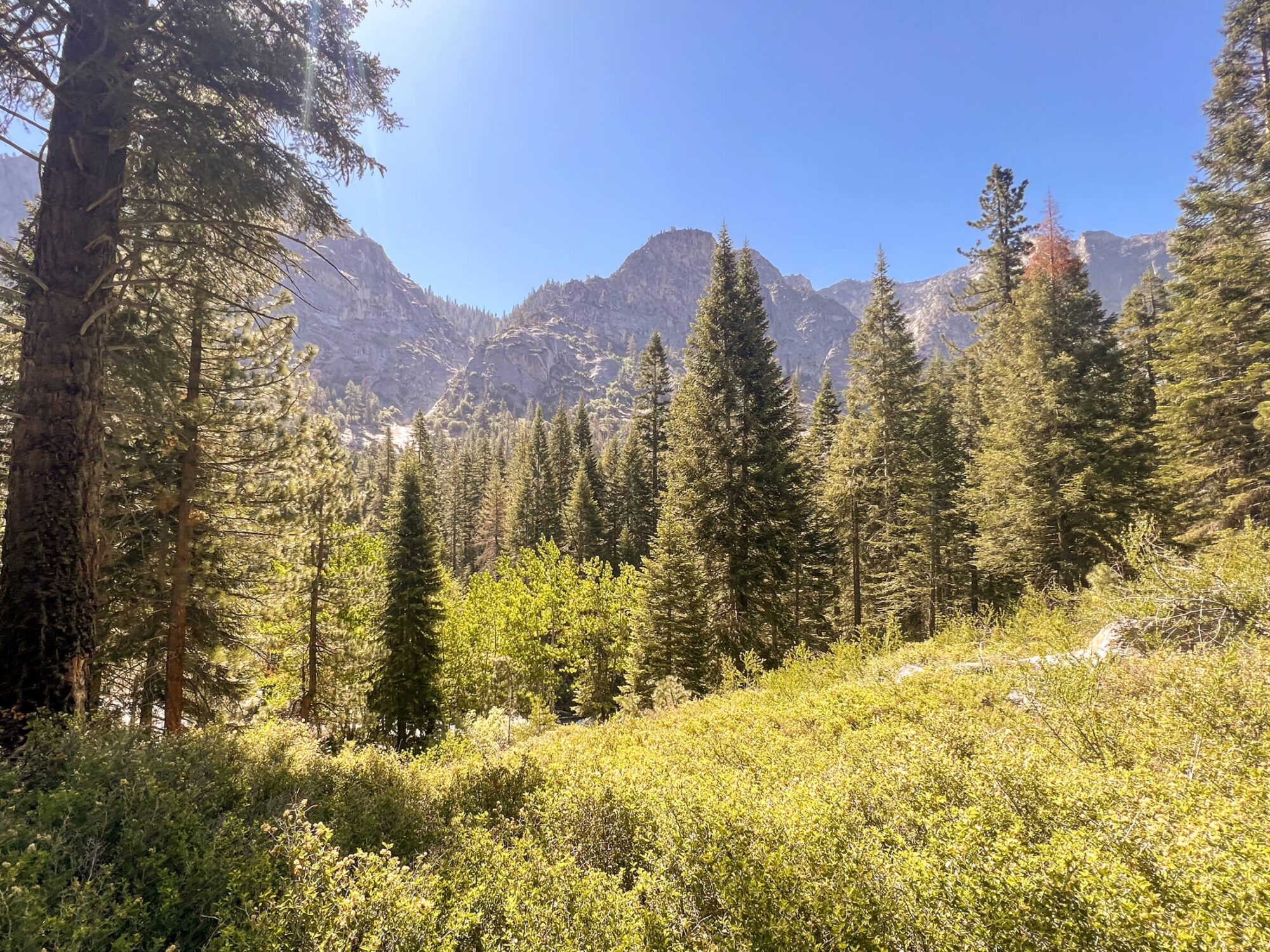
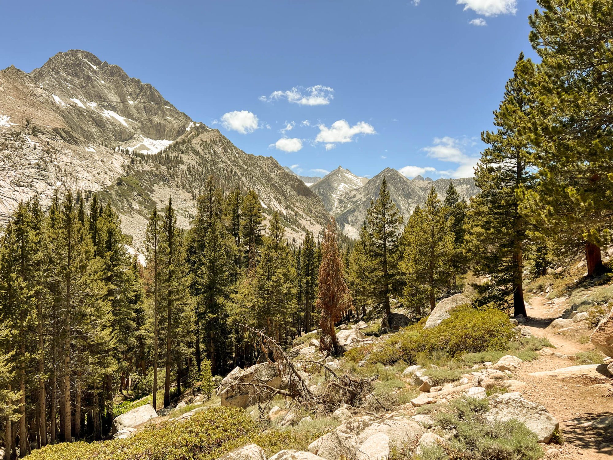
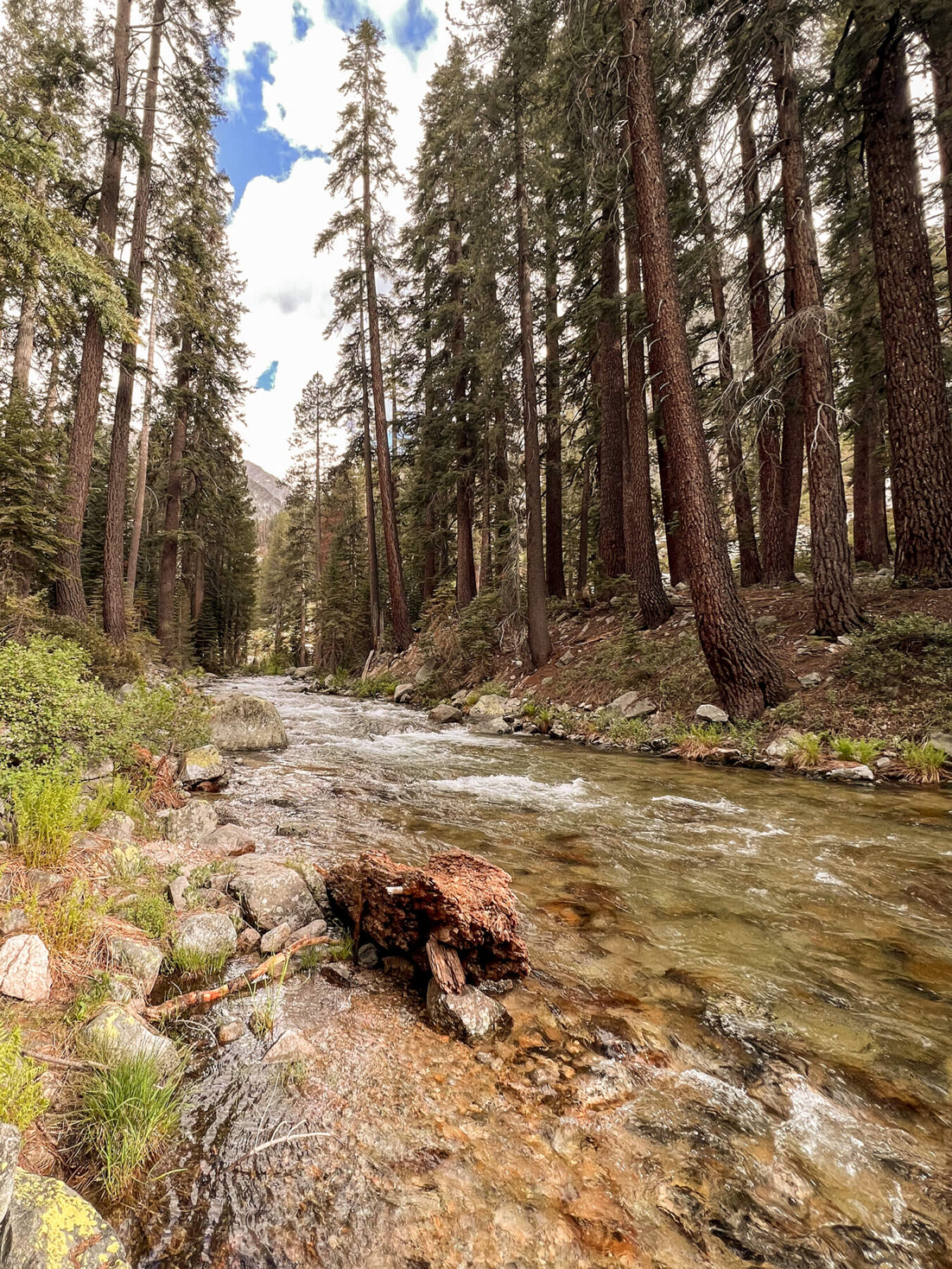
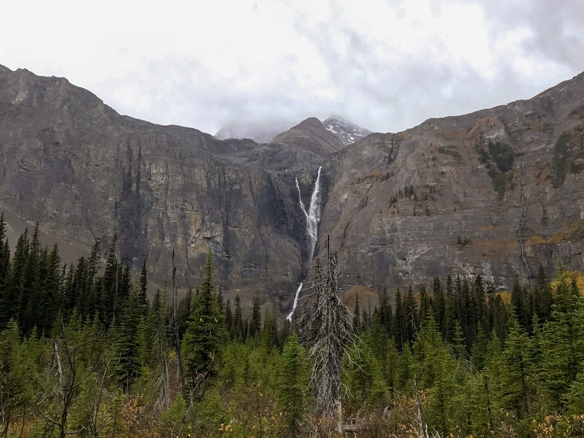
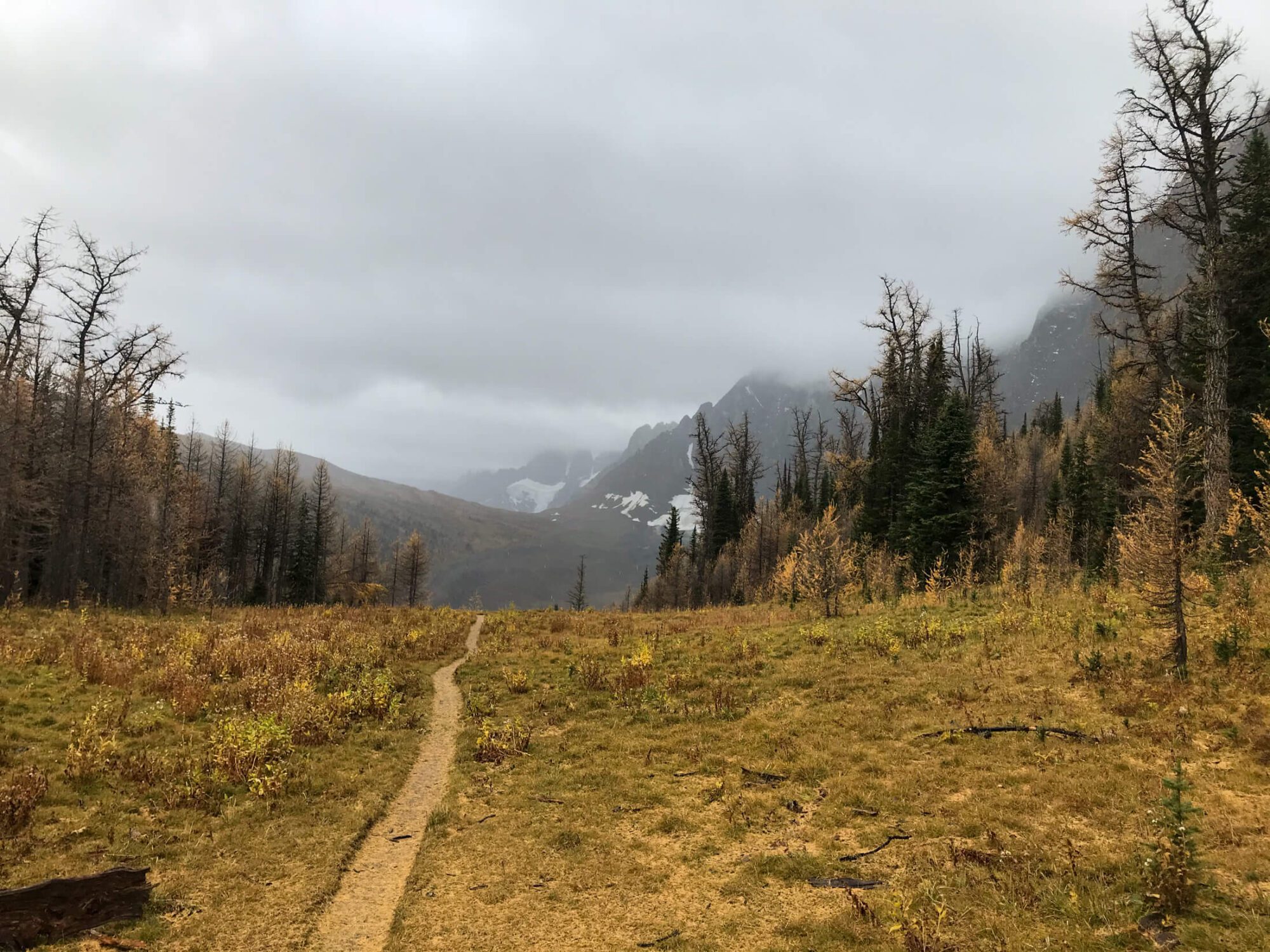
After departing from the Road’s End Ranger Station the trail follows a wide path through an open forest with excellent views to cliffs and peaks surrounding the canyon. Sun exposure in this section is high and shade is limited. After a couple miles, you’ll hit the junction for Bubb’s Creek trail where counterclockwise hikers take a right crossing the bridge over the South Fork Kings River. Clockwise hikers continue along the Paradise Valley trail which follows along the rivers west bank, The trail becomes quite lush with the moisture, nutrients, and spray from the river transforming the forest and providing some shade. The contrast is stark, where minutes ago there was a sandy wash, ferns and significant understory abounds. For 2 miles after the Junction with Bubbs the trail steadily climbs adding about 650ft (200 M) elevation before reaching the aptly named Mist Falls where an incredible torrent of water shrouds the entire trail in vapor and mist. This is a spectacular and refreshing location for lunch or a snack, just be mindful of the slippery rocks.
Mist Falls to Upper Paradise
5 Miles (8 KM)
1650ft (450M) Elevation Gain & 350 ft (100M) Loss
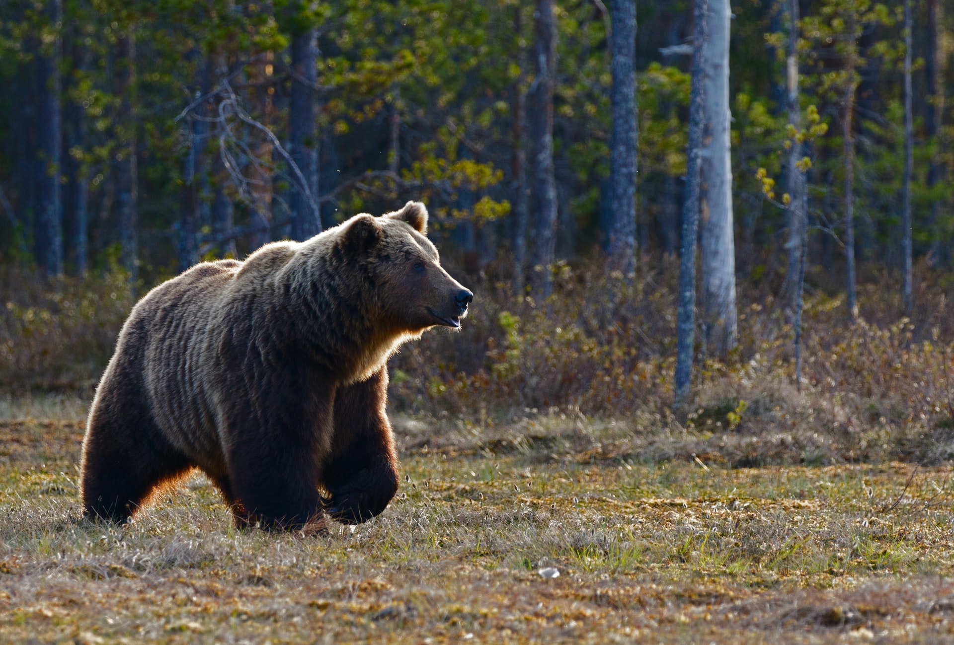
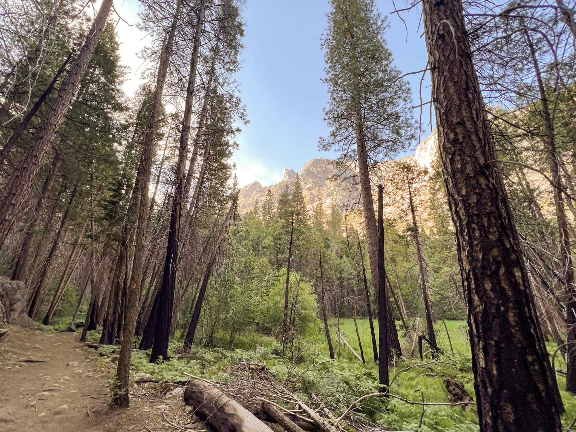
Leaving Mist Falls the trail continues its steady ascent navigating a short series of switchbacks half a mile after the falls. Views back down the river valley are spectacular and amplified in the morning as the sun’s rays highlight the canyon walls. The trail follows the river up the drainage as it flows through a series of deep and dramatic pools before widening and shallowing out near Lower Paradise Valley. Lower Paradise Valley is typically the first spot where camping is permitted, but for 2022 it was temporarily closed due to the presence of numerous dangerous trees. If you’re looking to camp in this area for the night continue on to Middle or Upper Paradise . This section of the trail provides numerous forested sections that serve as a lovely reprieve from the scorching Sierra sun. I was fortunate enough to see a bear about 150 ft in front of me on this section. Naturally, he took off the minute he heard me singing…
Upper Paradise to Woods Creek
5.5 Miles (9 KM)
1650ft (500M) Elevation GaIn
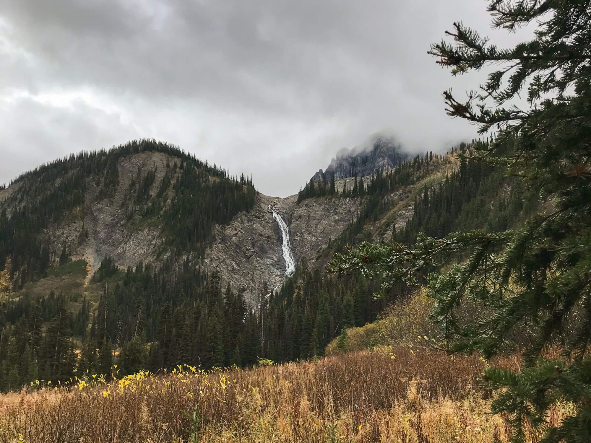
After departing Upper Paradise you’ll encounter the largest river crossing of this trip. There was once a bridge that crossed the South Fork Kings River here, but it was washed away in 2016. As of June 2022, there was no new bridge and a stream crossing is required here. The conditions are season dependent and day dependent. I encountered no issues with this crossing in early June , but every year/day can be different. Ask the ranger for any guidance when you pick up your permit as from time-to-time log jams form in the vicinity that can make the crossing easier. Look for the old bridge foundation to give you a bearing of where to head and avoid walking to far. Additionally, once you’ve made the crossing, find the remnants of the old bridge’s concrete foundation again to re-discover the trail. There are a couple trails that lead north (or to the left of the old fountain), do not take these, stay on the trail that heads straight then to the right and you’ll quickly rediscover the main trail. You’re now on the Woods Creek trail! Over the next 6 miles you’ll gain over 1600 ft of elevation (500M) in a steady fashion. Who said going up was hard! Following your crossing, you’ll initially hike out of sight of Woods Creek before the creek becomes visible a couple miles down the trail. Upon reaching Castle Domes Meadows area the views really begin to open up and you’re given a sampling of what’s to come. After staying right at the junction and joining up with JMT/PCT you’ll come to the suspension bridge and cross over Woods creek.
Woods Creek to Middle Rae Lake
6 Miles (10 KM)
2000ft (650M) Elevation GaIn
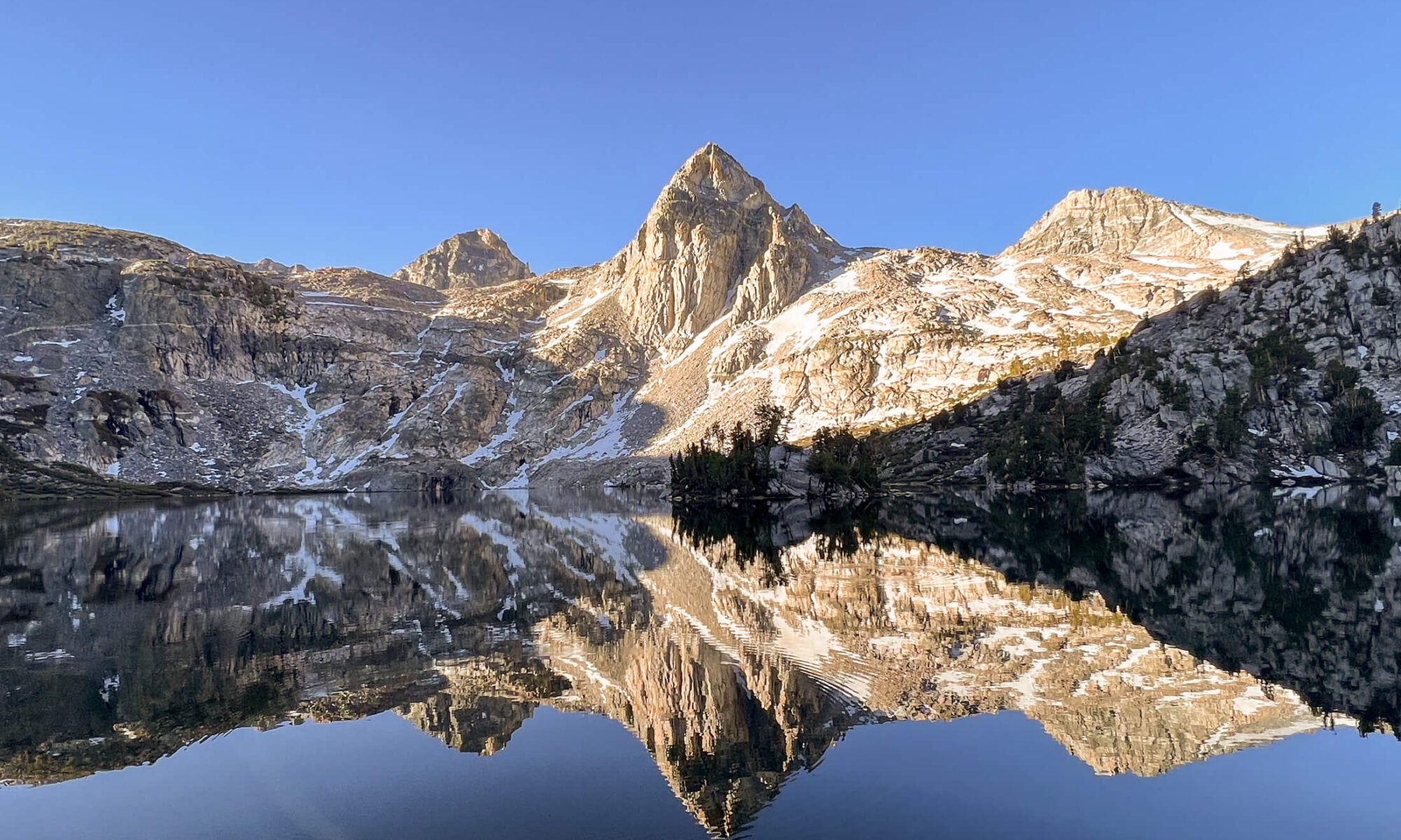
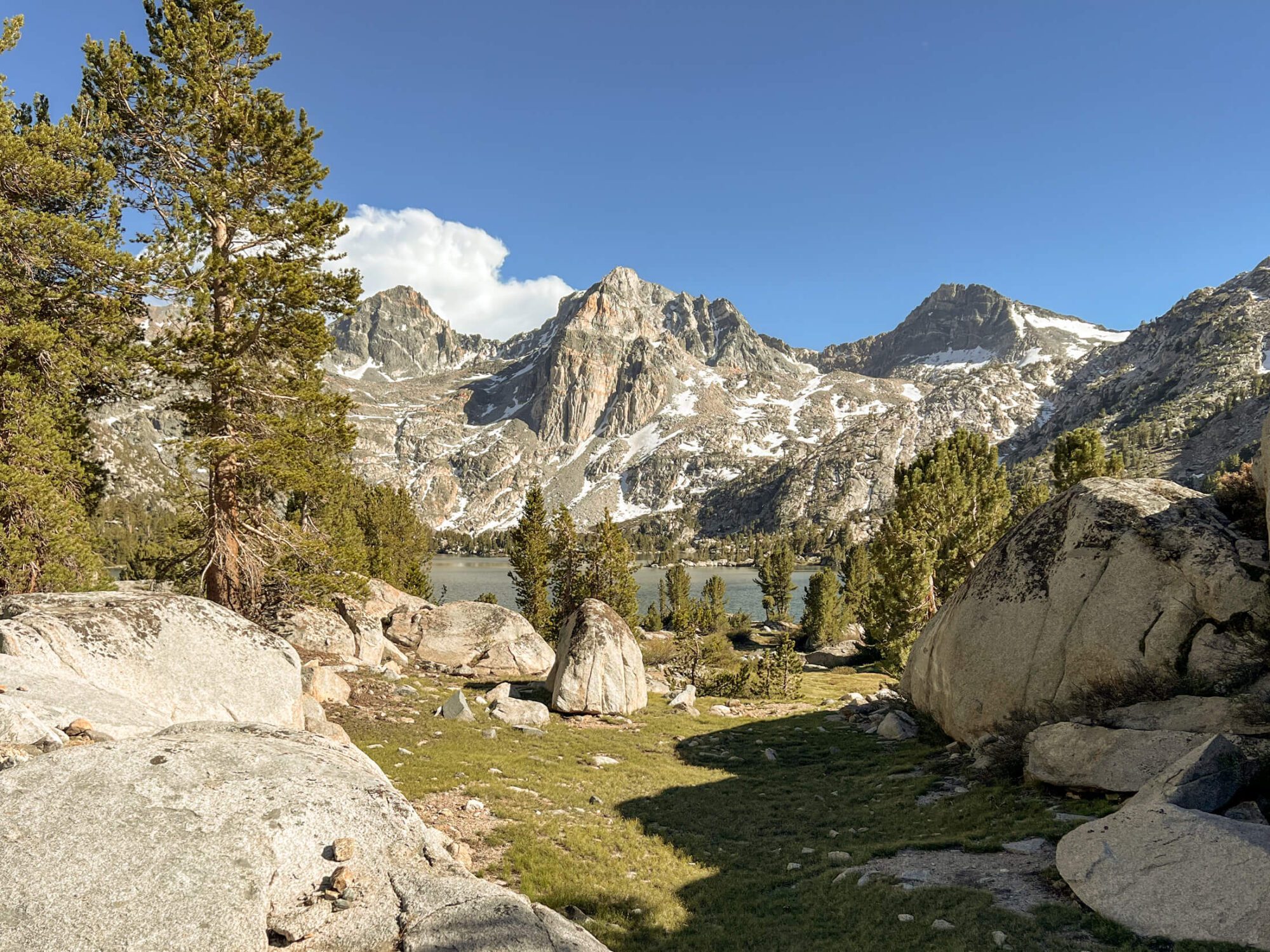
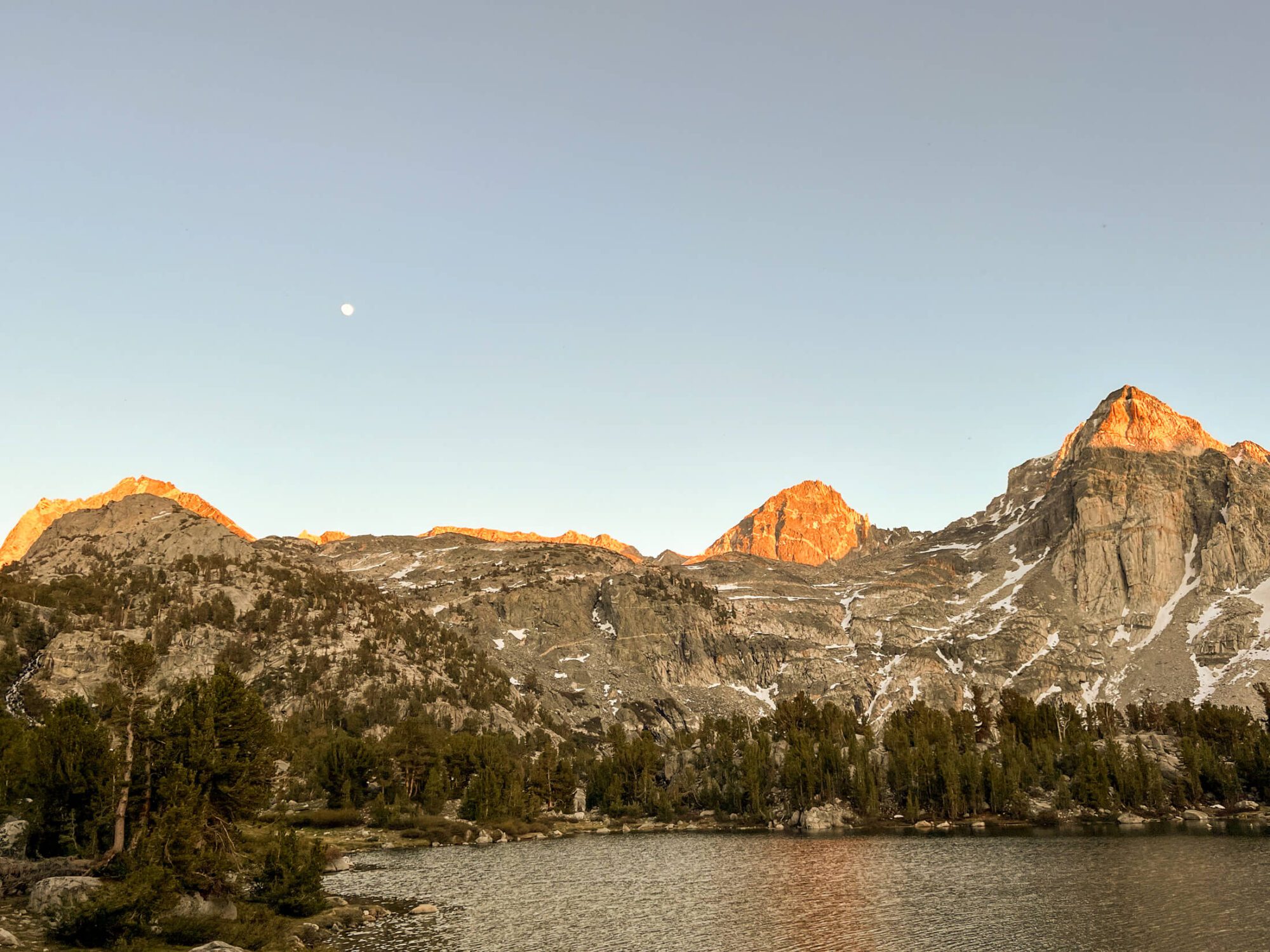
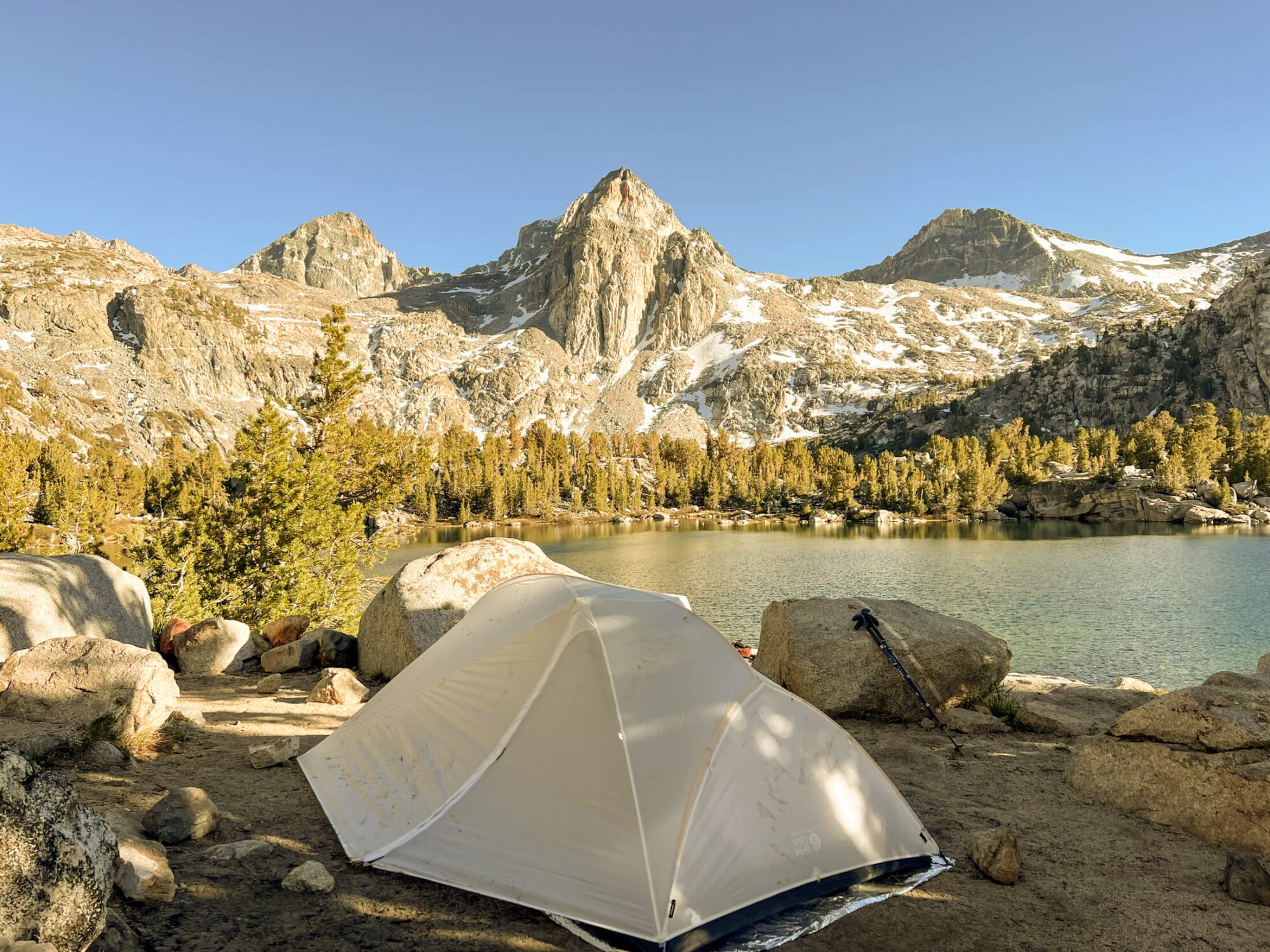
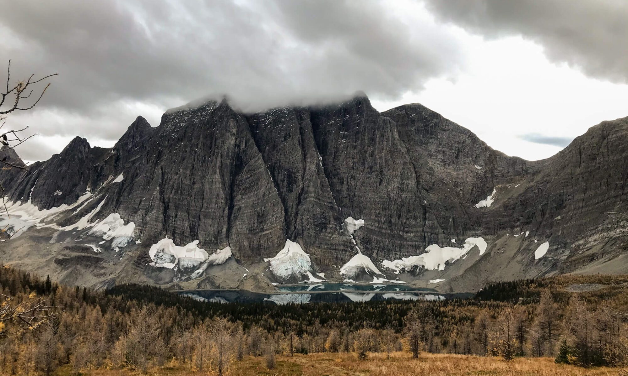
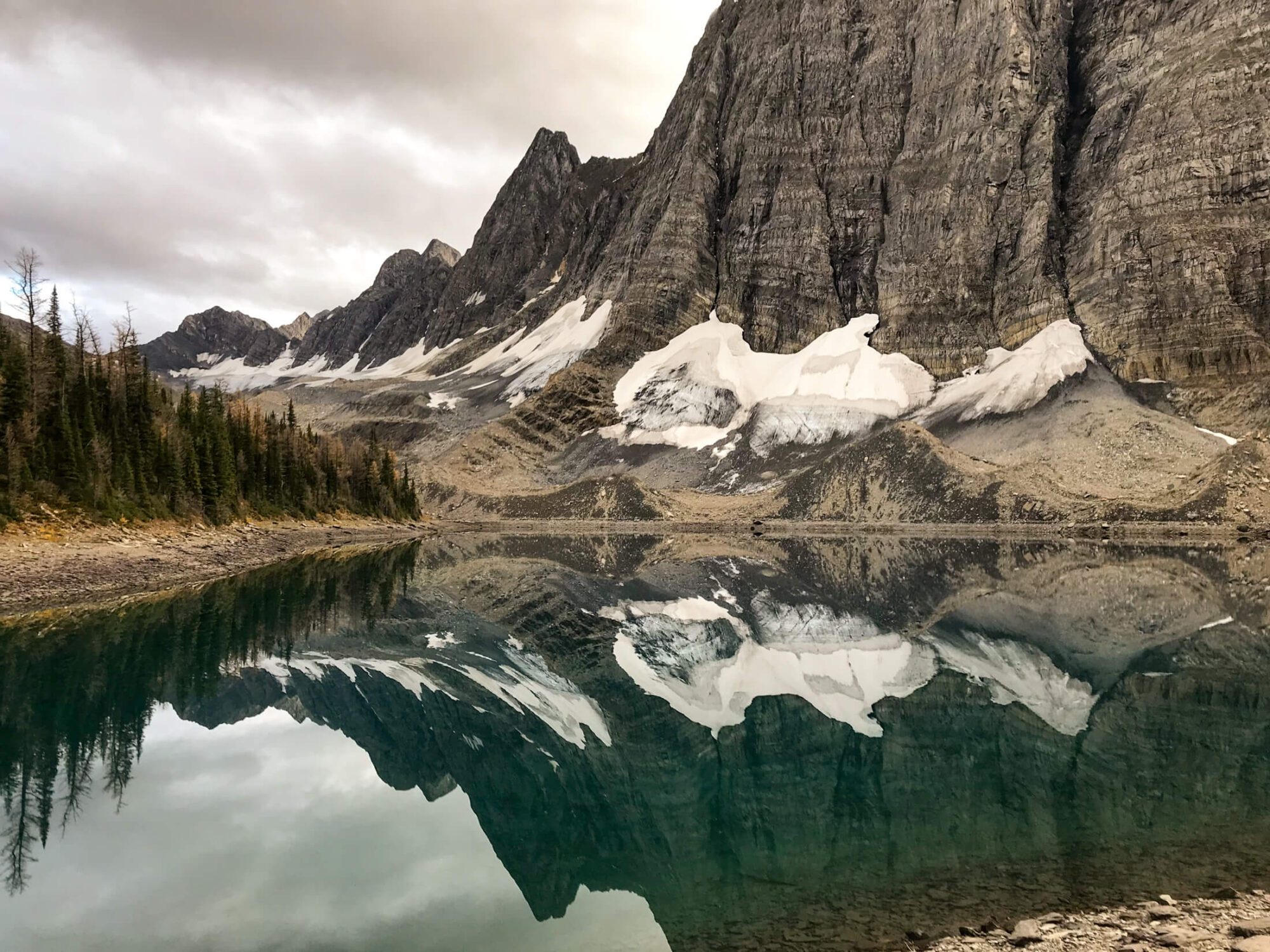
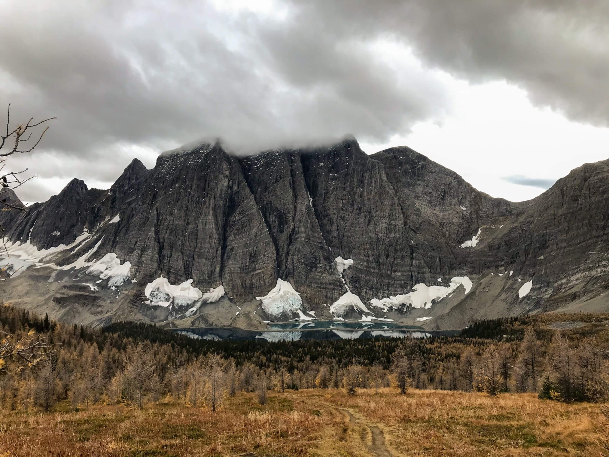
After crossing the suspension bridge over Woods Creek the trail climbs 1600 ft ( 500 M) to reach Dollar Lake and the junction with Baxter Lakes Trail. This climb is steady over the duration and crosses over various tributaries that flow into the South Fork Woods Creek. None of these crossings are technical and are likely seasonal flows, unfortunately in early June several were not crossable without conceding wet feet. After reaching Dollar Lake the trail remains relatively flat and you’ll cross another small flow that connects Arrowhead Lake with Dollar lake and re-soaks your feet just as they were starting to dry. Arrowhead lake offers a decent size camping zone with food storage boxes, should your legs be too weary to go any further or are looking to avoid the crowd at Rae. Arrowhead is also a great second night option for those looking to stay near Rae Lakes for longer than 1 night. At this point the trail makes one more climb to reach the majestic Rae Lakes. There are several spots to camp near lower Rae lakes, but many backpackers continue past the ranger station to Middle Rae Lake. Camping here provides an optimal view over Middle Rae Lake to the Painted Lady and peaks behind. Sunset and sunrise here is guaranteed to delight!
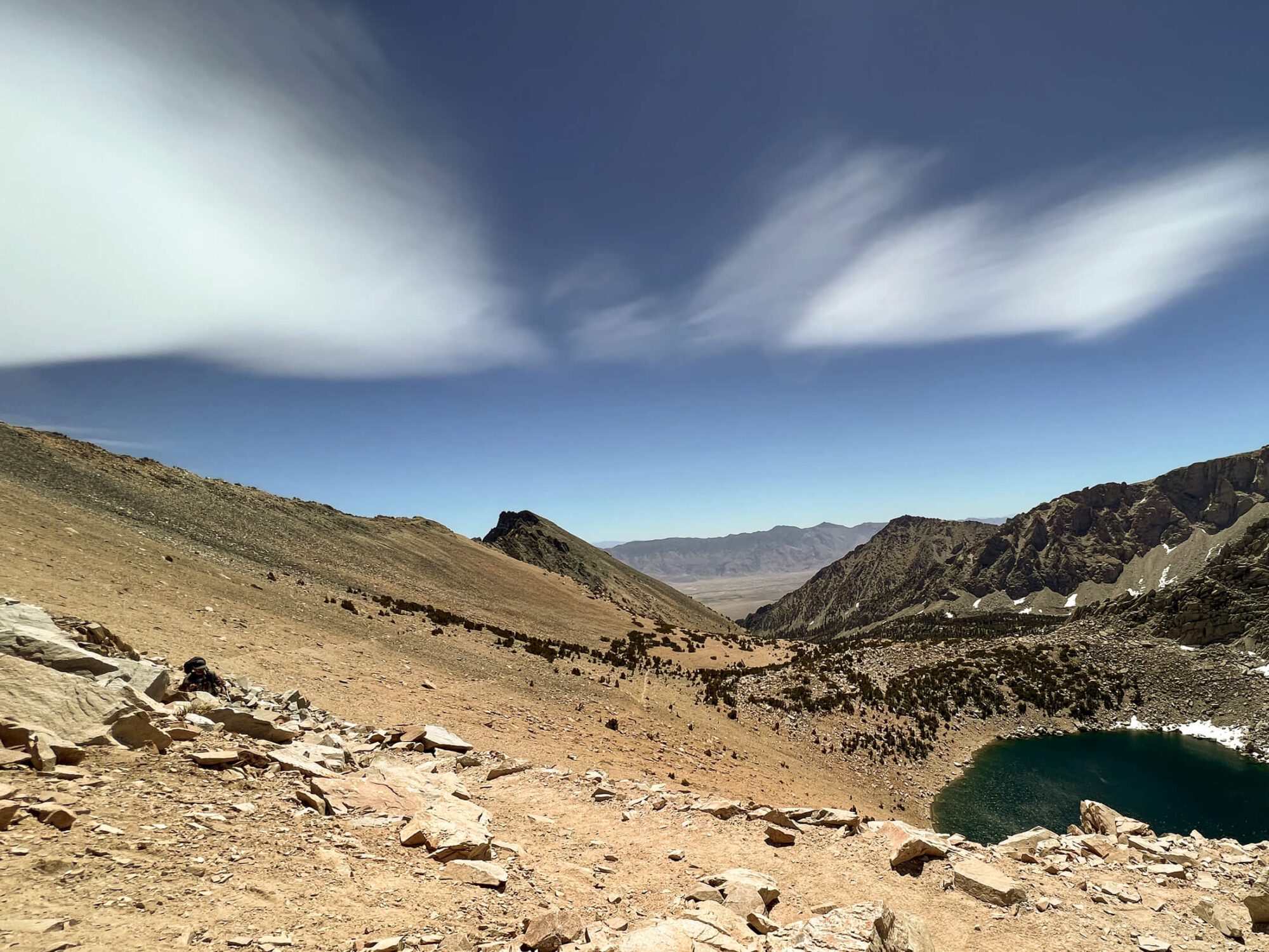
Middle Rae Lakes to Glen Pass
2.5 Miles (4 KM)
1500ft (450M) Elevation Gain
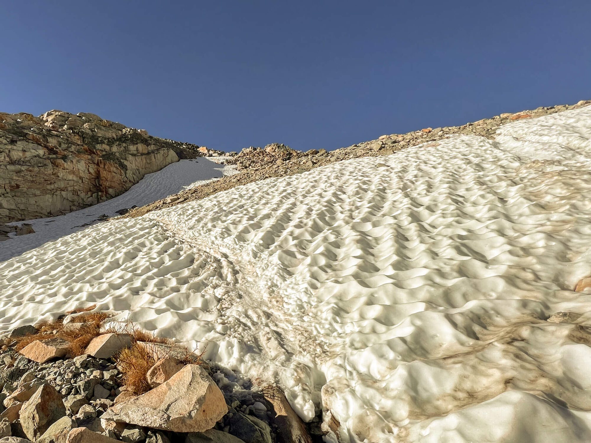
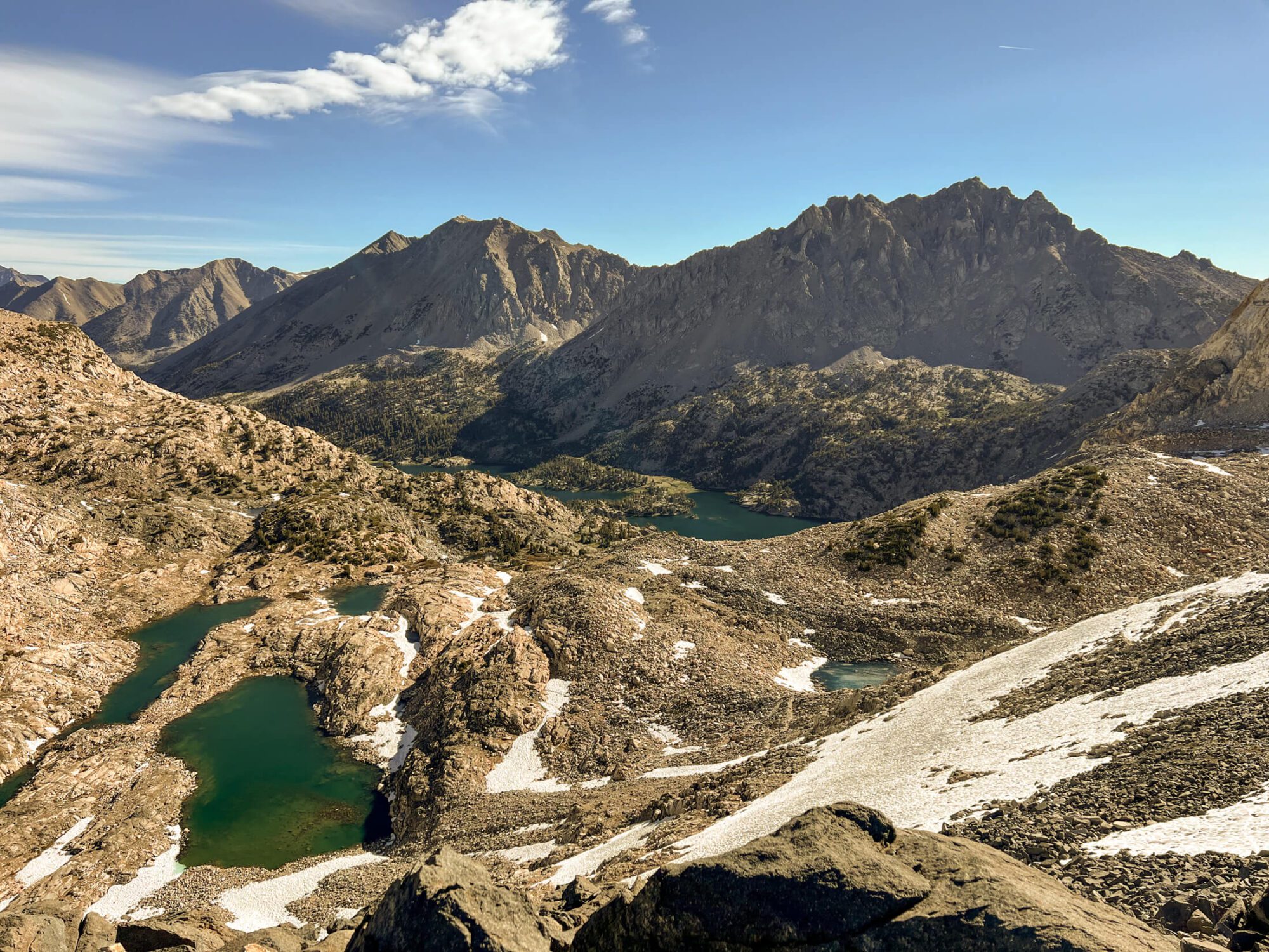
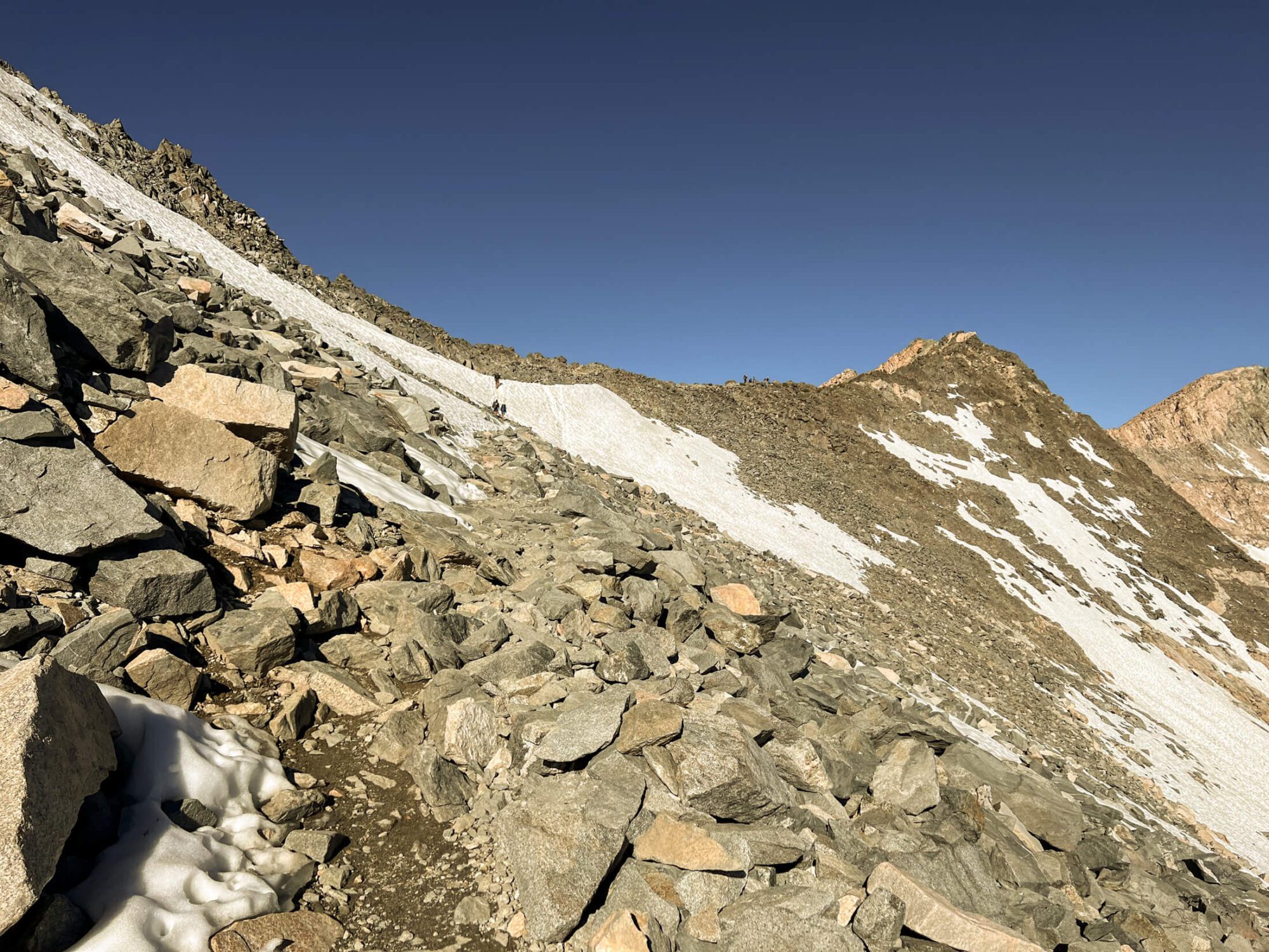
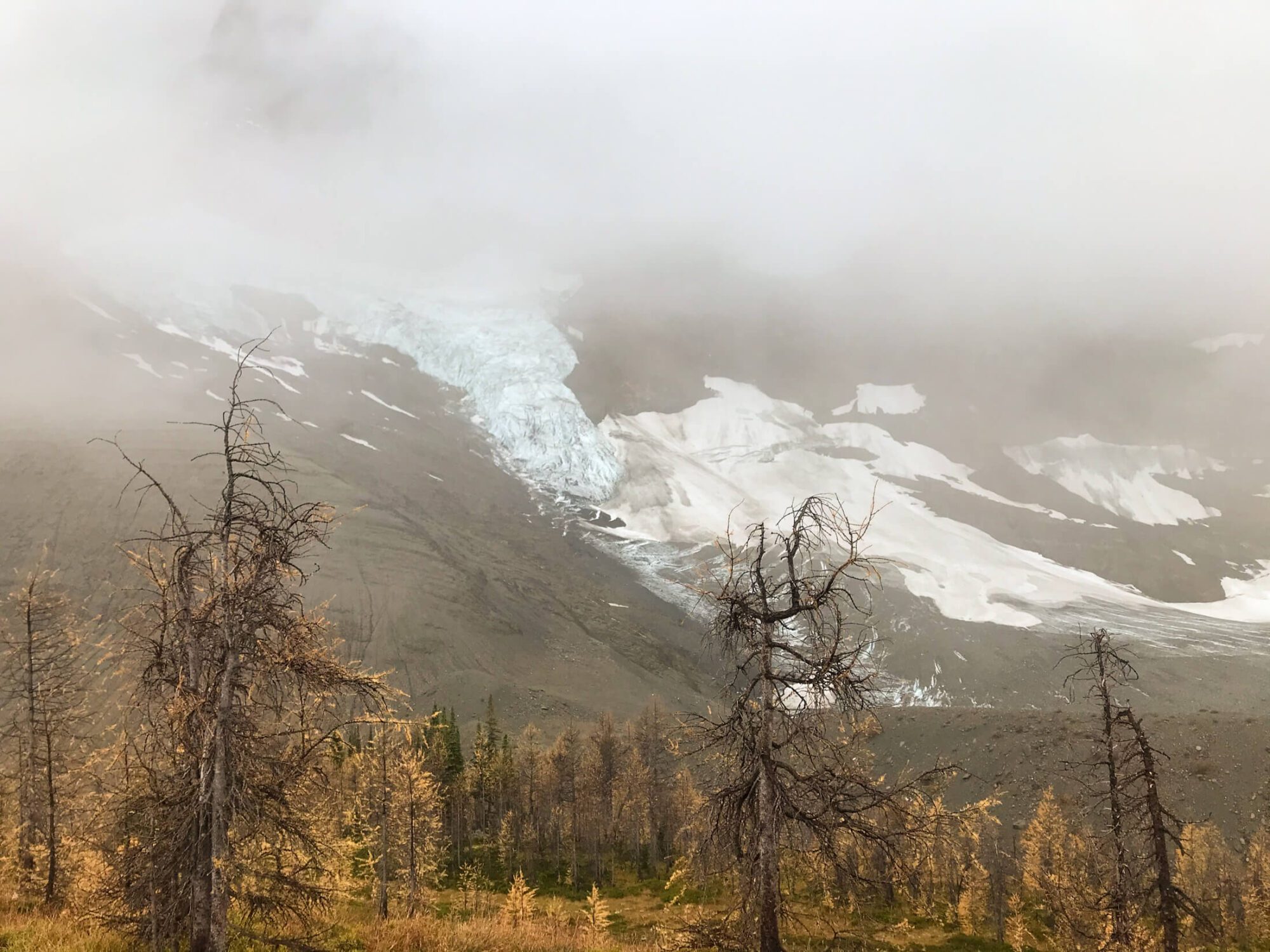
If you’ve stayed at Middle Rae, you’ll start your day with incredible views as you follow the shoreline along the northern side of Upper Rae Lake. After walking for about ½ mile (1 KM) you’ll encounter another small water crossing where Upper Rae drains into Lower Rae. There were no rocks to cross during my trip. If you have an alternate pair of shoes/sandals you’ve been using for river crossings, I’d consider wearing them from camp to this point given. It’s a short distance and you’ll save the hassle of making the change. If not, embrace the morning footbath! Shortly after negotiating this crossing you’ll encounter the junction for the Sixty Lakes Basin to the right, a great place to explore for those spending additional time in the area. If not, continue to the left, it’s time to tackle Glen Pass! From Upper Rae Lakes the trail gains 1500ft (450 M) over 1.8 Miles (3 KM) to the trail’s highest point at Glen Pass. This ascent is negotiated over a series of switchbacks that climb over loose rock and snow, in the early-season. If you’re hiking early in the year, this is where you’ll want your microspikes so have them ready. An early morning start is also helpful, as the snow is firm and far less strenuous to navigate without postholing at every step. Regardless of the season, It’s tough work making the climb, but the awe-inspiring views of alpine lakes and jagged peaks are balm to your burning quads. Following a final step set of switchbacks the trail cuts across sharply skirting the ridge to the right before reaching the summit of the pass. Be especially careful here if traveling on snow or ice as the slope to the right is steep and a fall would have consequences. After navigating this final section, take it all in. A breathtaking view greets you in all directions!
Glenn Pass to Charlotte Lake Junction
2 Miles (3.5 KM)
1300 ft (400M) Elevation Loss
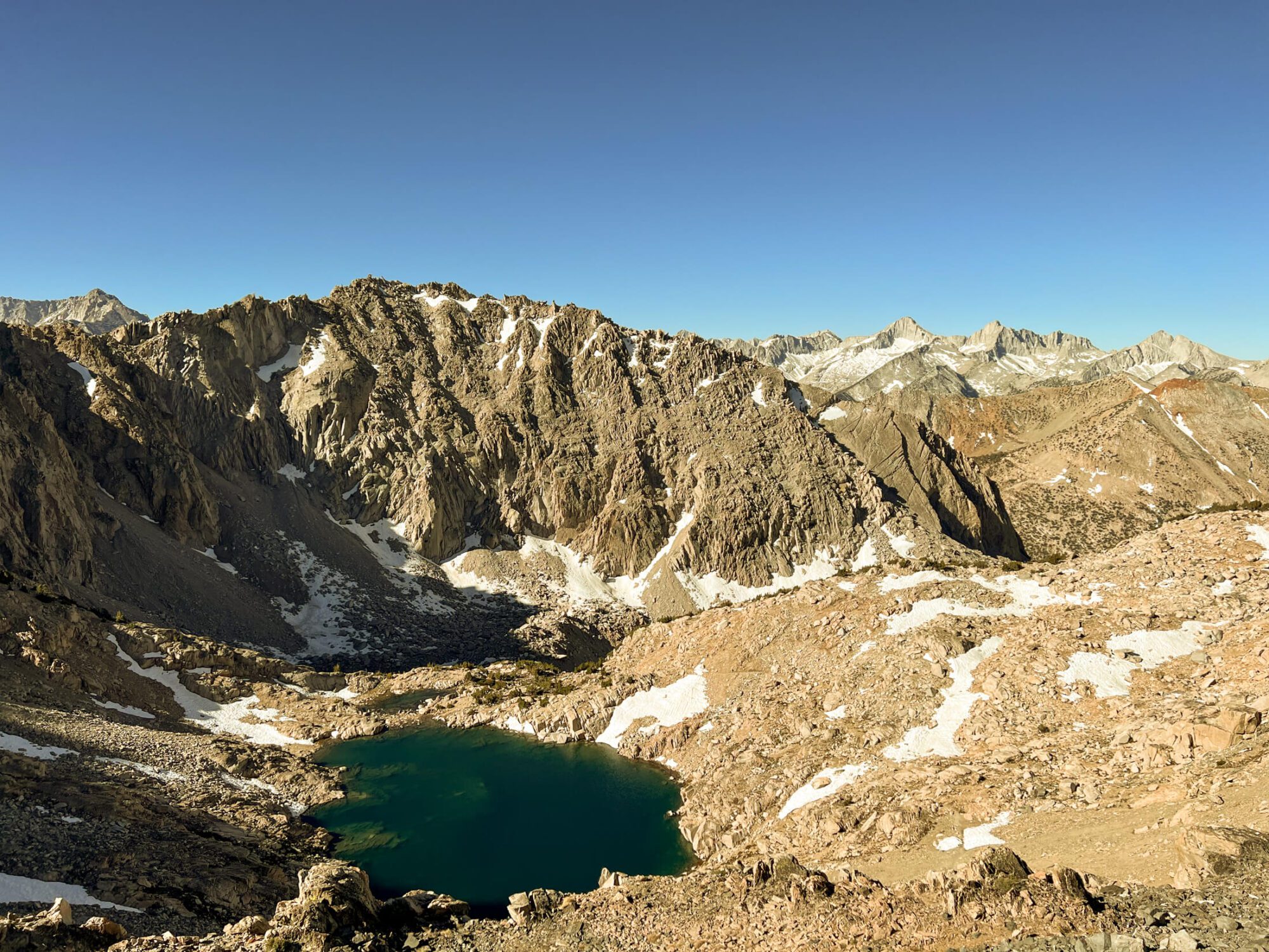
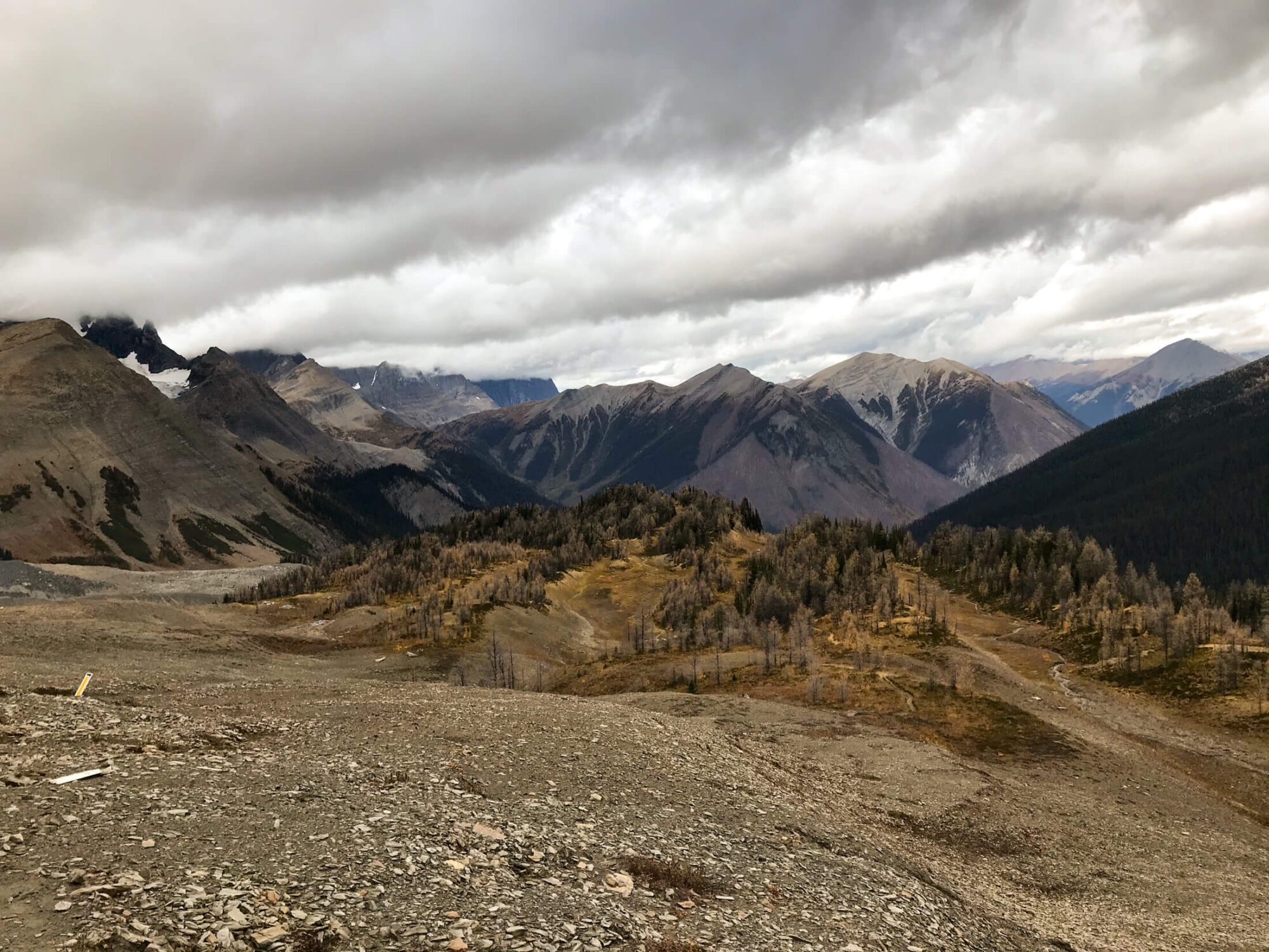
After enjoying your time atop Glen Pass, it is time to begin your descent. The path coming down navigates a series of switchbacks, but without the same level of loose rock as your ascent. Additionally, this slope south facing exposure makes it unlikely that you’ll encounter any more snow travel. You’ll descend towards a small alpine lake for around ½ mile rapidly losing 350 ft (100 M) of elevation along the way. After this first lake the trail follows along a small creek that drains into a lower lake about 1 Mile (0.6 KM) down. There are several camp spots nearby these small lakes that may be useful for hikers traveling counterclockwise and looking to get an early start going up Glen Pass. After passing the second lake, you’ll slowly leave behind the alpine environment and continue for another 1.2 miles (2.0 Km) losing 525ft (160 M) of elevation before reaching the trail for Kearsarge Pass. Kearsarge pass makes for an excellent alternative entry point or add on loop (9 KM round trip to the pass) that takes in scenic views from the pass, Kearsarge Lakes and Bullfrog Lakes. Staying on the main trail you’ll continue for ¼ mile (0.35KM) before coming to another junction with Charlotte Lake trail. Charlotte lake lies ⅔ Mile (1 KM) to the right with this trail also serving as the access point for exploring the Gardiner Basin area.
Charlotte Lake Junction to Junction Meadow
4 Miles (6.5 KM)
2600ft (800 M) Elevation Loss
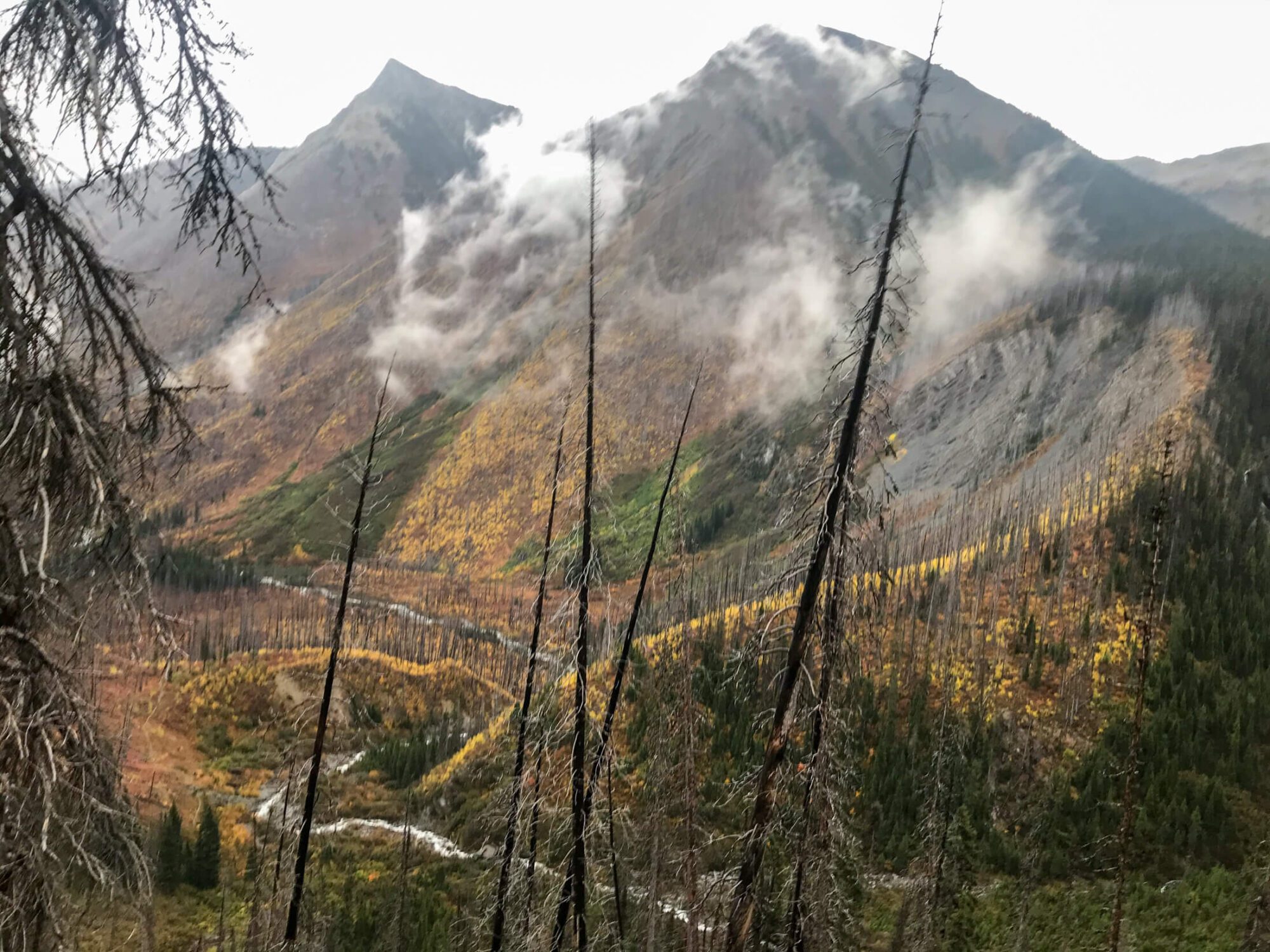
Following the junction with Charlotte Lake, you’ll encounter a series of switchbacks before continuing a steady descent alongside a creek and down the valley. From Charlotte junction you’ll lose 360M of elevation in 2.7km walking through forested areas with consistent openings to the mountains above and valley below before reaching Vidette Meadow junction . Upon reaching Vidette Meadow junction you’ll stay right following the Bubbs creek trail and bidding adieu to PCT and JMT trails as they exit to the left. From here the trail parallels Bubbs creek as it descends providing innumerable magnificent views of the crashing torrent as it descends down into the valley below. About 4km after lower Lower Vidette meadow you’ll arrive at Junction meadow. For those looking to cover move ground, an excellent camping spot with bear boxes lies an extra 0.6 miles down the trail adjacent to Bubbs Creek.
Junction Meadow to Sphinx Creek
6 Miles (10 KM)
2000ft (600 M) Elevation Loss
Leaving Junction meadow you’ll continue to parallel Bubbs Creek and walk through a mix of forest and meadow. Catch views of the surrounding cliffs that encircle the valley walls and marvel at the perfectly eroded drainages where spring runoff funnels down into Bubbs creek. After 3 miles (4.8 KM) and a 300M loss in elevation you’ll reach Charlotte Creek which offers a collection of campsites to the left of the trail and near Bubbs Creek. As you continue past this area and down to Sphinx Creek look for the looming silhouette of Charlotte Dome (10,630 ft 3240 m) to the right. A further 3.3 Miles (5KM) down the trail you’ll come to a junction at Sphinx Creek. The Campsite here is the last (first) place to camp if completing this hike Clockwise (counterclockwise).
Sphinx Creek to Road's End
4 Miles (6.5 KM)
1300 ft (400 M) Elevation Loss
From Sphinx you’ll walk for about ⅔ of a mile (1KM) before encountering your final set of switchbacks. As you descend, look for views of the Sphinx 2786M to the southwest. Once you’ve reached the bottom of the switchbacks you’ll make your way across Bubbs Creek (unbridged) before crossing the bridge over South Fork Kings River and retracing your steps back to Road’s end and your car.
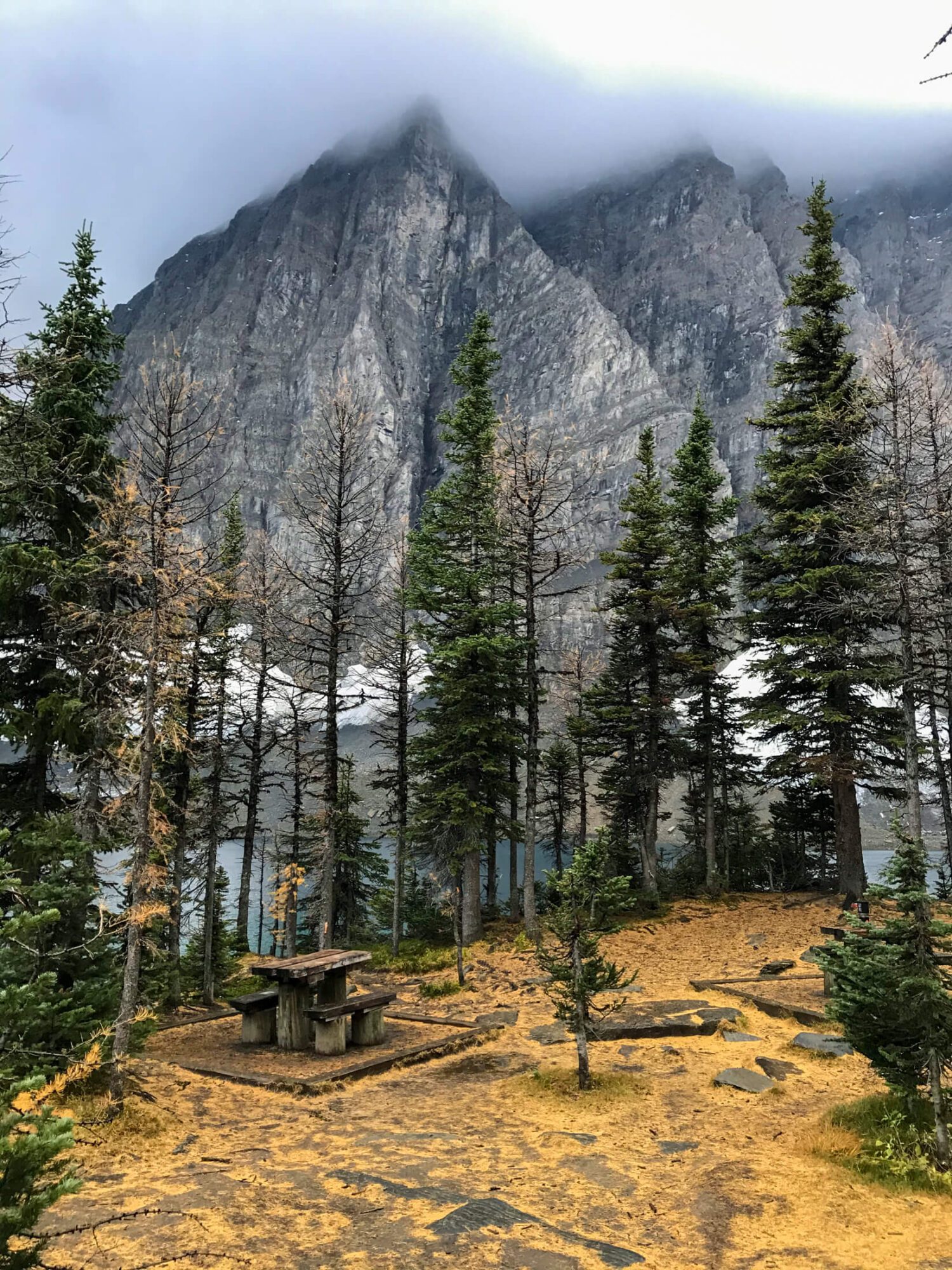
Campsites on the Rae Lakes Loop
Unlike popular treks like the Grand Canyon’s rim to rim, there are no truly established campsites on the Rae Lakes Trail. Specifically, you will not have luxuries like tent pads or outhouses, but you have the luxury of getting to camp (mostly) where you please! There are multiple locations that are frequently utilized by backpackers and often feature well used/obvious tent sites, food storage boxes, and established fire rings. Bear canisters are mandatory for hiking the Rae Lakes Loop and priority in the food storage boxes is given to thru hikers on the PCT and JMT. However, if there is room many hikers pop their bear canisters inside to make it easily discoverable and eliminate the risk that a bear will accidentally roll your cache into a nearby lake or river should it attempt to get inside. You’ll find food storage boxes at the following locations:
- Sphinx Creek
- Charlotte Creek
- Lower Junction Meadow
- Junction Meadow (East Creek)
- Vidette Meadow
- Woods Creek crossing/John Muir Trail
- Upper Paradise Valley
- Middle Paradise Valley
- Lower Paradise Valley
- Arrowhead Lake
- Middle Rae Lake
Itinerary options for hiking Rae Lakes
The traditional Rae Lakes Loop can be completed in 2 to 5 days, but numerous side-trails offer multiple ways to spend more time exploring this incredible area. The following itineraries have been provided as a starting point for helping you plan your trip. Only you know what mileage you’re comfortable with, so make an informed decision. Hiking and backpacking are rare activities where faster isn’t necessarily better or more enjoyable. The last thing you want is to be stressing out about whether or not you’ll make it to camp before dark.
Please note the following restrictions when planning your trip and check for up to date restrictions prior to booking and starting your trip:
- Camping in Paradise Valley is limited to two nights.
- Camping at Rae Lakes is limited to one night per lake.
- No camping at Lower Paradise Valley due to the number of dead trees in the area.
All mileages and elevations are rounded and approximate.
Rae Lakes Loop in 2 days / 1 night
Crazy? Maybe a little, but trail runners tackle the Rae Lakes Loop in one day of quad destroying bliss. So, if you’re really short on time and are comfortable logging high miles in the High Sierra this trip is for you.
Clockwise via Woods Creek
- Day 1: Road’s End to Middle Rae Lakes via Woods Creek
- 21.5 Miles (34 KM)
- 5900 ft (1800 M) Elevation Gain
- 300 ft (100 M) Elevation Loss
- Day 2: Middle Rae Lakes to Road’s End via Bubbs Creek
- 19 Miles (31 KM)
- 1600ft (500 M) Elevation Gain
- 7200 ft (2200 M) Loss
- Day 1: Road’s End to Middle Rae Lakes via Woods Creek
Notes:
In this short of time, clockwise is the way to go as it allows you to spend a night at the loop’s namesake (Rae Lakes) and get up and over Glen Pass first thing in the morning on day 2. Going up Glen first has a number of benefits including: reducing the chance of having to delay due to midday thunderstorm and not having to conquer the toughest part of the trail at the end of a long day when you’re fatigued. If you’re going with this itinerary, I’d start as early as possible. I completed this same schedule on my first day hiking to Rae Lakes. I picked up my permit at 7:00am and finished at middle Rae Lake shortly after 5:00pm with about 30-45 minutes of stoppage time (for lunch/snacks). It felt tough, but manageable. On the 2nd day it’ll be all downhill after completing Glenn pass as your first order of business and you should be back at Road’s end in the late afternoon/early evening, leaving you plenty of time to drive home, get a few hours sleep, and make that early morning Zoom meeting the next day. Weekend warrior this trip was built for you!
Rae Lakes in 3 days / 2 nights
There are a couple ways to complete this backpacking trip in 2 nights. If you cannot live with the FOMO of hiking to Rae Lakes and not camping there you will need to have one really big day and 2 medium days. If you’re alright with passing by Rae Lakes and not camping there you can spread the mileage over the three days on the trail.
Here are the options:
Option 1 - Clockwise via Woods Creek and camp at Rae Lakes
This is the choice for you if you MUST camp at Rae Lakes! I get it, this was me. Here’s how to do it:
- Day 1: Road’s End to Middle Rae Lakes via Woods Creek
- 21.5 Miles (34 KM)
- 5900 ft (1800 M) Elevation Gain
- 300 ft (100 M) Elevation Loss
- Day 2: Middle Rae Lakes to Junction Meadow, Charlotte Creek, or Sphinx Creek
- 9.5 Miles (15 KM) to Junction
- 1600 ft (500 M) Elevation Gain
- 4000 ft (1200 M) Elevation Loss
- Day 3:Junction Meadow, Charlotte Creek, or Sphinx Creek to Road’s End via Bubbs Creek
- 9.5 Miles (15 KM) to Junction
- 3200ft (1000 M) Elevation Loss
- Day 1: Road’s End to Middle Rae Lakes via Woods Creek
Notes:
Similar to the 1 night itinerary, clockwise is the way to go as it allows you to spend a night at Rae Lakes and get up and over Glen Pass first thing in the morning on day 2. By knocking off Glen Pass first thing you reduce the chance of delay due to midday summer thunderstorms and avoid having to complete the toughest part of the trail at the very end of a long day.
Day 2 gives you some flexibility on the final campsite, allowing you to lengthen the day and subsequently reduce your hike out on day 3 should you desire. If you’re itching for more miles, trips to Charlotte Lake or Kearsarge Pass/Lakes can easily be added to the second day. This is pretty much the itinerary I hiked, except I added a loop trip to Kearsarge Pass, Kearsarge Lakes and Bullfrog Lake to Day 2.
Option 2 - Clockwise via Woods Creek with even-ish mileage
- Day 1: Road’s End to Woods Creek Crossing via Woods Creek
- 16 miles (25 KM)
- 3900 ft (1200 M) Elevation Gain
- 300 ft (100 M) Elevation Loss
- Day 2: Woods Creek to Junction Meadow
- 16 miles (25 KM)
- 3600 ft (1100 M) Elevation Gain
- 4000 ft (1200 M) Elevation Loss
- Day 3: Junction Meadow to Road’s End via Bubbs Creek
- 9.5 Miles (15KM)
- 3300 ft (1000 M) Elevation Loss
- Day 1: Road’s End to Woods Creek Crossing via Woods Creek
Notes:
If you’re looking to space the mileage out, this itinerary splits the elevation gain almost equally between the first and second days while leaving the shorter day for the final day to get where you need to go post hike. Downside is that you don’t get to camp in the alpine areas which are, in my opinion, the most scenic.
Option 3 - Counterclockwise via Bubbs Creek with even-ish mileage
- Day1: Road’s End to past Charlotte Lake Junction via Bubbs Creek . Stay near one of the small lakes about 1.5 Miles (2.5 KM) North of Charlotte Lake Junction and before Glen Pass.
- 16 Miles (25 KM)
- 6600 ft (2000 M) Elevation Gain
- Day 2: Charlotte Lake Junction area to Upper Paradise
- 16 Miles (25 KM)
- 1000ft (300 M) Elevation Gain
- 5300 0ft (1600 M) Elevation Loss
- Day 3: Upper Paradise to Roads End
- 9 Miles (14 Km)
- 2300 ft (700 M) Elevation Loss
- Day1: Road’s End to past Charlotte Lake Junction via Bubbs Creek . Stay near one of the small lakes about 1.5 Miles (2.5 KM) North of Charlotte Lake Junction and before Glen Pass.
Notes:
This itinerary will park you very close to Glen Pass for day 2 and you get the majority of the tough mileage out of the way on a tough day 1. The mileage is more evenly distributed, but this first day will be very tough.
Rae Lakes in 4 days / 3 nights
Completing the Rae Lakes Loop in 4 days / 3 nights seems to be the Goldiloks zone for many backpackers. Here are couple options to do it in this timeframe:
Option 1 - Clockwise via Woods Creek
- Day 1: Road’s End to Upper Paradise
- 9 Miles (14 Km)
- 2300 ft (700 M) Elevation Gain
- Day 2: Upper Paradise to Middle Rae
- 12 Miles (19 KM)
- 3600 ft (1100 M) Elevation Gain
- 300 ft (100 M) Elevation Loss
- Day 3: Middle Rae to Junction, Charlotte Creek, Sphinx.
- 9.5 Miles (15 KM) to Junction
- 1600 ft (500 M) Elevation Gain
- 4000 ft (1200 M) Elevation Loss
- Day 4: Junction Meadow, Charlotte Creek, or Sphinx Creek to Road’s End via Bubbs Creek
- 9.5 Miles (15 KM) from Junction
- 3200ft (1000 M) Elevation Loss
- Day 1: Road’s End to Upper Paradise
Notes:
There are tough days in this itinerary, but the mileage is manageable for most backpackers.. You get to enjoy the splendor of Rae Lakes for a night and can summit Glen Pass in the morning. A winning itinerary, if I say so myself.
Option 2 - Counterclockwise via Bubbs Creek
- Day 1: Road’s End to Lower Vidette Meadow
- 13 Miles (20 KM)
- 4600 ft (1400 M) Elevation Gain
- Day 2: Lower Vidette Meadow to Middle Rae Lake
- 7 Miles (11 KM)
- 2600 ft (800 M) Elevation Gain
- 1600 ft (500 M) Elevation Loss
- Day 3: Middle Rae Lake to Upper Paradise
- 12 Miles (19 KM)
- (100 M) Elevation Gain
- 3600 ft(1100 M) Elevation Loss
- Day 4: Upper Paradise to Road’s End
- 9 Miles (14 KM)
- 2300 ft (700 M) Elevation Loss
- Day 1: Road’s End to Lower Vidette Meadow
Notes:
By making a big climb to Lower Vidette Meadow on Day 1 you put yourself in good shape to make the trek up to Glen Pass on the morning of Day 2. Ideally you’ll have a good amount of time in the later afternoon to kick back at Rae Lakes.
Rae Lakes in 5 days / 4 nights
Spend a little bit more time in the area and break up the big up days into smaller and more manageable chunks.
Option 1 - Clockwise via Woods Creek
- Day 1: Road’s End to Middle Paradise Valley
- 8 Miles (12 KM)
- 2000 ft (600M) Elevation Gain
- 300 ft (100M) Elevation Loss
- Day 2: Middle Paradise to Woods Creek
- 8 Miles (12 KM)
- 2000 ft (600 M) Elevation Gain
- Day 3: Woods Creek to Middle Rae Lake
- 6 Miles (10 KM)
- 2000 ft (600 M) Elevation Gain
- Day 4: Middle Rae Lake to Junction Meadow
- 9 Miles 14 KM
- 1600 ft (500 M) Gain
- 4000 ft (1200 M) Loss
- Day 5: Junction Meadow to Road’s End
- 10 Miles (16 KM)
- 3300 ft (1000 M) Loss
- Day 1: Road’s End to Middle Paradise Valley
Notes:
This itinerary groups the lighter mileage with the larger elevation gain and the longer mileage with the larger descents. The shortest day is to Rae lakes providing ample time for relaxation here.
Option 2 - Counterclockwise via Bubbs Creek
- Day 1: Road’s End to Charlotte Creek
- 7 Miles (11 KM)
- 2300 ft (700 M) Elevation Gain
- Day 2: Charlotte Creek to Charlotte Lake
- 9 Miles (14 KM)
- 3900 ft (1200 M) Elevation Gain
- Day 3: Charlotte Lake to Arrowhead Lake
- 7 Miles (12 KM)
- 1600 ft(500 M) Elevation Gain
- 2000 ft(600 M) Elevation Loss
- Day 4: Arrowhead Lake to Upper Paradise Valley
- 10 Miles (16KM)
- 3600 ft (1100 M) Elevation Loss
- Day 5: Upper Paradise Valley to Road’s End
- 9 Miles (14 KM)
- 2300 ft (700 M) Elevation Loss
- Day 1: Road’s End to Charlotte Creek
Notes:
This itinerary once again groups the lighter mileage and larger elevation gain and longer mileage with larger descents. If you’re going clockwise and looking to split mileage evenly between the days you won’t be able to camp at Rae Lakes. This itinerary includes a 1 mile side trip to camp at Charlotte Lake on Day 2 which is a nice spot to camp and puts you in reasonable proximity to Glen Pass for Day 3.
More time? Adapt the Itineraries!
Add a low KM day or zero KM day in the Rae Lakes and Arrowhead lakes alpine area to any of these itineraries to give yourself more time to explore. Maybe you spend the day relaxing lakeside or day hiking into the Sixty Lakes Basin (3 miles each way from Upper Rae Lakes). Remember, if you’re staying at Rae Lakes you’ll have to move your basecamp as camping is limited to one night per lake.
Itineraries too long? Break up a day. Camping is permitted almost everywhere on this loop, so break any of the days up into manageable chunks!
Packing list breakdown
Hikes like Rae Lakes Loop are more enjoyable the lighter your pack. A lighter backpack helps you cover more mileage and more elevation with way less effort making big days more realistic, not to mention more comfortable!
If you’re new to backpacking, don’t stress out about buying the latest and greatest equipment. Save money and use things you already own that can be repurposed for backpacking, rent gear or borrow stuff from a well-equipped friend. Later, when you’ve gained more experience, modify your kit and change out gear as you get a better understanding of what creature comforts you can and can’t live without.
Here’s some recommended gear for backpacking Rae Lakes Loop. Treat the links below like a buffet to jump ahead to the individual item recommendation or keep scrolling down to read through the entire list.
Essential Items
- Tent
- Backpack
- Sleeping mat
- Backpacking pillow
- Sleeping bag or quilt
- Water purification
- Trowel, TP, & Hand Sanitizer
- Swiss army knife
- Stove & fuel canister
- Lighter & Matches
- Backcountry cookset
- Water bottle or reservoir
- Water storage container
- First aid kit
- Trekking poles
- Bear Canister
- Headlamp with red light mode
- GPS, compass & map
- Battery back-up & charging cable
Luxury Items (very optional)
Clothing and Accessories
Additional Items
- Permit
- America the Beautiful Pass (or park entrance pass)
- Microspikes (season dependent)
- Sunscreen & SPF lim balm
- Bug Spray
- Tooth Brush & Toothpaste
- Food
- Emergency Medical Insurance (if traveling from outside the US)
Essential Items
Tent
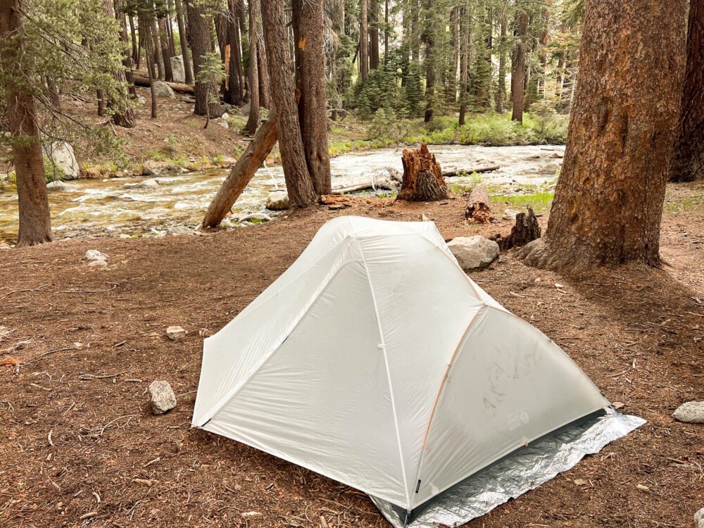
I upgraded to Mountain Hardwear Strato UL2 last year and used it on the Rae Lakes Loop. It’s semi-freestanding, double walled and weighs in at a mere 2.5 lbs. The best part is unlike many 2-person tents, it doesn’t have a tapered floor and can fit 2 extra wide sleeping pads side-by-side with no overlap. A rare feature in this class of tent! It’s cozy, but workable for two and palatial for one!
If you’re looking for a completely freestanding tent that offers a bit more durability, check out the Big Agnes Copper Spur UL2. It’s unique blend of functionality, livability, weight, and durability earn high praise and Big Agnes’s customer service is outstanding!
For an incredible ultralight option, check out the single wall Durston X-Mid Pro which weighs in at a mere 20 oz (565g). There’s a reason this tent has developed a serious cult following among ultralighters.
Backpack
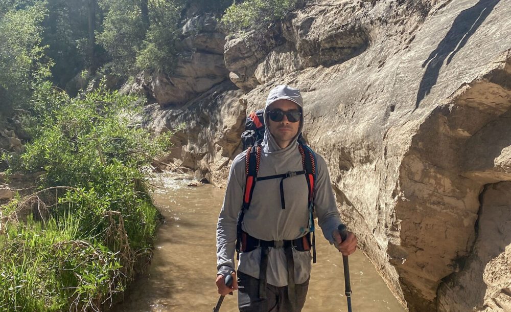
If you’re just getting into backpacking, there is nothing wrong with using a large-size backpack with a decent suspension system (and good hipbelt) or borrowing one from a friend. Going this route gives you time to decide what features you need and whether or not backpacking (and the gear) is something you want to invest in. Whatever backpack you use, make sure you have a good fit before by following this guide to backpack sizing. When I first started backpacking, I used a 60L travel backpack, our Khmer Explorer Travel Set on Canada’s West Coast Trail. While not designed for hiking, it worked great despite my ridiculous overpacking!
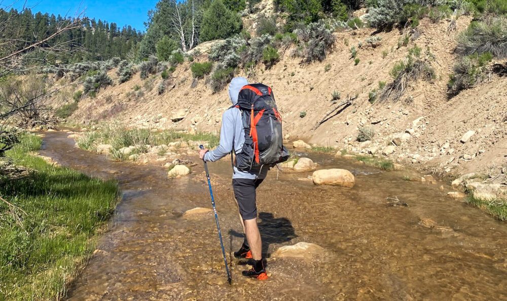
If you’ve begun dialing in your backpacking kit and moving towards a lightweight set-up, check out either the Osprey Exos or Woman’s Eja. At under 3 lbs these packs provides a great compromise between barebones ultralight packs and the heavier feature-laden packs. Their excellent suspension systems prevent the dreaded swampy/sweaty back on hot days. That’s my Exos hiking the Narrows in Zion in the photo above.
For a similar option that checks in even a little bit lighter in weight, check out the Gregory Focal and Facet (women’s) lineup:
If you’re an extreme gram counter, you might like the Hyperlite 3400 southwest. It’s 100% waterproof and constructed from ultralight dyneema fabric. Being ultralight you’ll sacrifice features, so if you hate getting a swampy back (that’s me) you may prefer the Osprey or Gregory despite the weight penalty. Backpacking gear is always a zero sum game!
Check the price of the Hyperlite 3400 southwest:
Sleeping mat
I used to have terrible sleeps in the backcountry until I switched to the Therm-a-Rest NeoAir X-lite. It’s incredibly lightweight, comfortable, and packs down to the size of a Nalgene bottle. This is probably one of my favorite backpacking items! Get one. You won’t regret it. Sleep well!
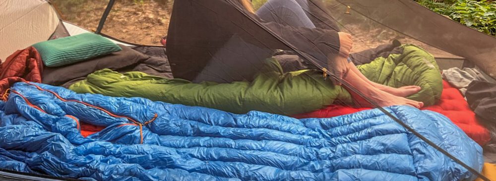
Sleeping bag or quilt
Patagonia’s sleeping bags are 5 star!! I received one as a gift several years ago and it has been nothing short of perfect. Weighing only 822 g (29 oz) it’s lightweight and packs down small! I found the 30°F / -1°C to be perfect for most outings – if it gets colder you can always layer up! Like all Patagonia products, it’s not cheap, but they stand behind their gear and the quality matches the price point. If you spend a lot of time in colder environments they also make a 20°F / -7°C version . These bags are a worthwhile splurge!
If you’re looking for an even lighter-weight option, consider going for a sleeping bag quilt. Feathered Friends Flicker UL Quilt Sleeping Bag has won numerous awards and is a stalwart among ultralight backpackers. With a weight starting at 526 g (1 lb 2.5 oz), I can see why!
Backpacking pillow
Yes, you can sleep with a pillow not made of bunched up clothes in the backcountry. Check out the Nemo Fillo Elite. It packs down ultra small and provides an unprecedented level of comfort after a long day on the trail. Once you try one you won’t imagine how you lived without!
Water purification
I love the Steripen. It’s light, portable and only takes minutes to purify a liter of water in a Nalgene. Press the button, place the pen in your bottle, and stir for a couple minutes!
Make sure to bring tablets as a backup though should you run into any technical problems/dead battery with your Steripen.
Trowel, Toilet Paper & Hand Sanitizer
The lack of facilities on the Rae Lakes Trail make a trowel a requirement for this trip. Follow minimum impact camping principles and be sure to dig a cathole a minimum of 6 inches deep and at least (500ft) 200m away from any established trails, campsites, or water (creeks, lakes, rivers etc.). Pack out your TP.
Don’t forget a small bottle (1 oz) of hand sanitizer.
Swiss army knife
For fixing gear or cutting food, make sure to bring swiss army knife.
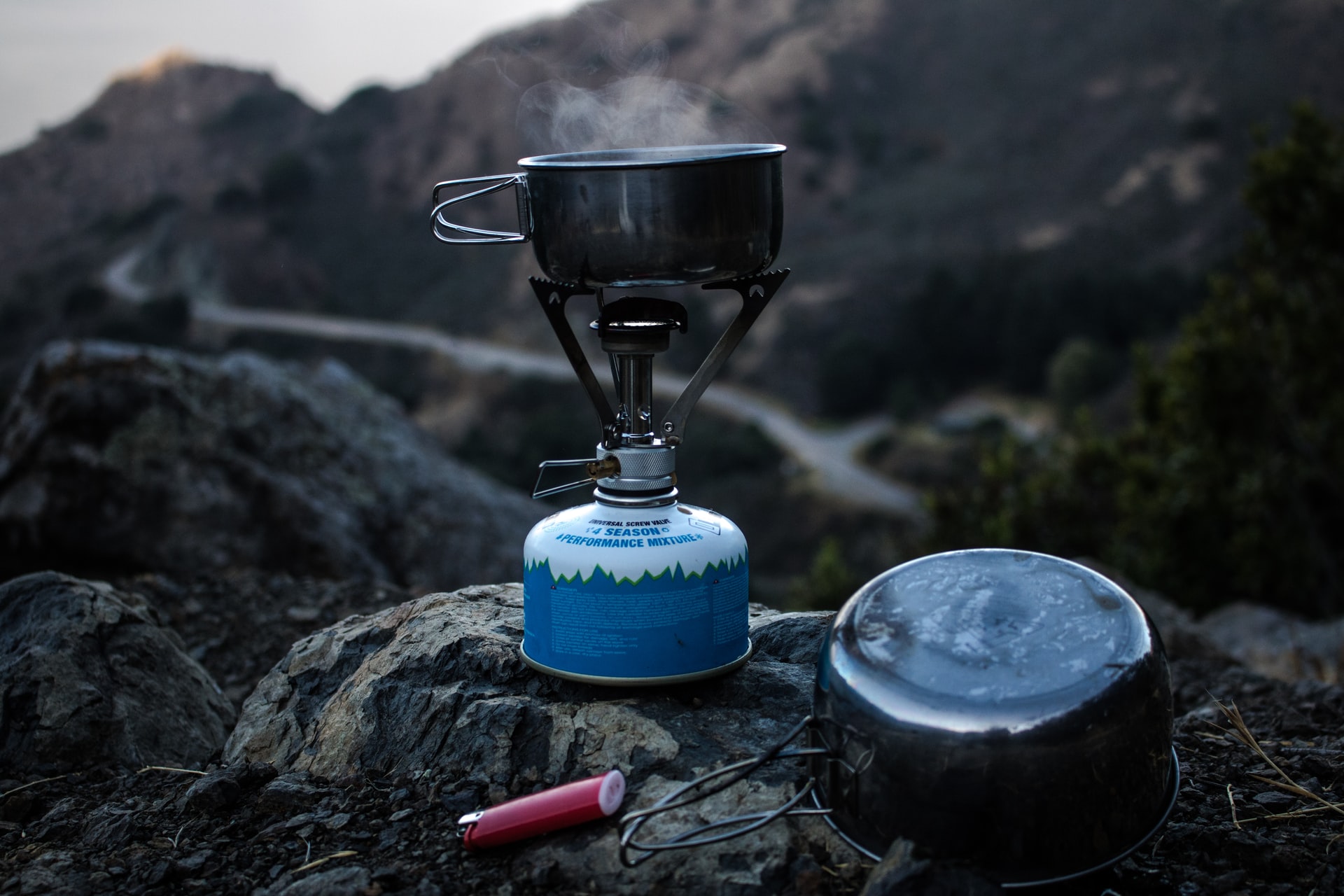
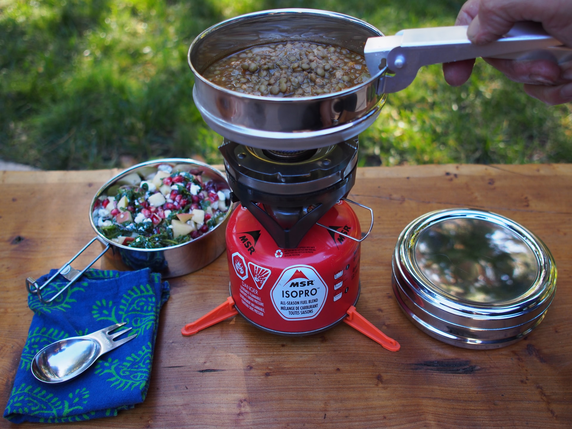
Stove & fuel canister
Lightweight, convenient, and reliable, the MSR pocket rocket has been my go-to backpacking stove for years.
Lighter and matches
A little baby bic lighter is all you need. I often bring a small pack of matches wrapped in ziplock bag as well for backup or you could bring a small pack of waterproof ones.
Backcountry cookset
The GSI Halulite Microdualist II is a compact, lightweight two-person cookset that can fit a MSR pocket rocket and a fuel canister inside.
If you’re looking to buy a minimalist stove and cookset the MSR PocketRocket Stove Kit is an all-inclusive solution.
Water bottle or reservoir
Nalgene are always a backcountry favorite. Check prices at Backcountry /REI. If you’re cutting weight or looking for a way to save a buck, a simple smart water is the go-to for ultralight backpackers.
Alternatively, a hydration reservoir allows you to stay hydrated continuously without stopping to grab and open a bottle.
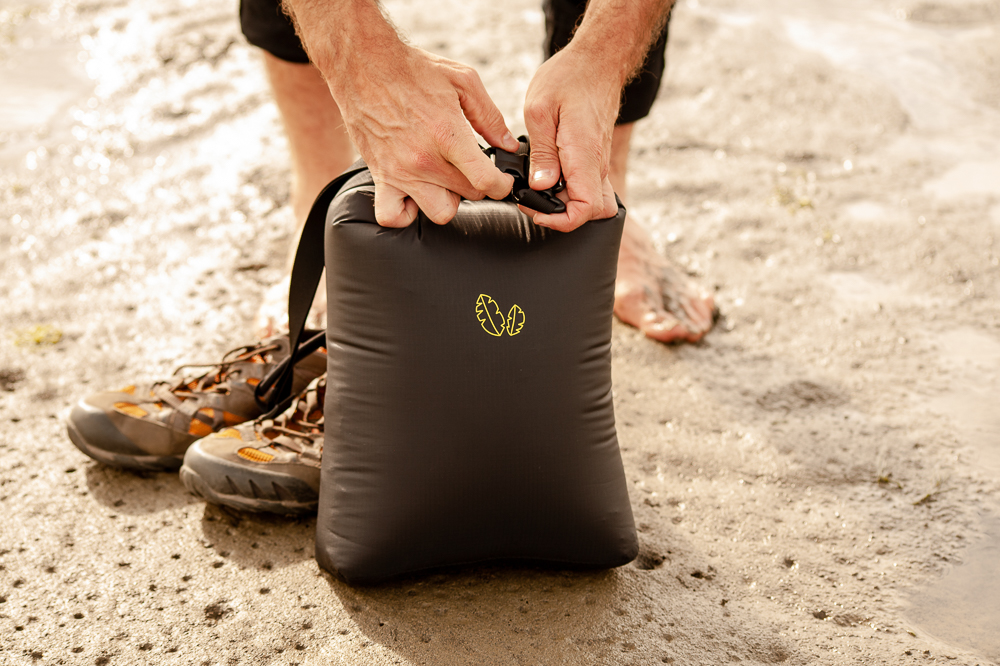
Water container
Extra water storage capacity makes cooking that much easier and camp life more enjoyable, so consider the MSR DromLite Bag or Dromedary. They are a must for trips without reliable water sources where hauling extra water is essential.
First aid kit
From blisters, to scrapes, and cuts, a first aid kit is an essential item to have. The pre-built kits from Adventure Medical Kits offer varying sizes for party size and trip length. At the end of your trip, write down any items you used and replace them right away so your kit is ready for your next adventure.
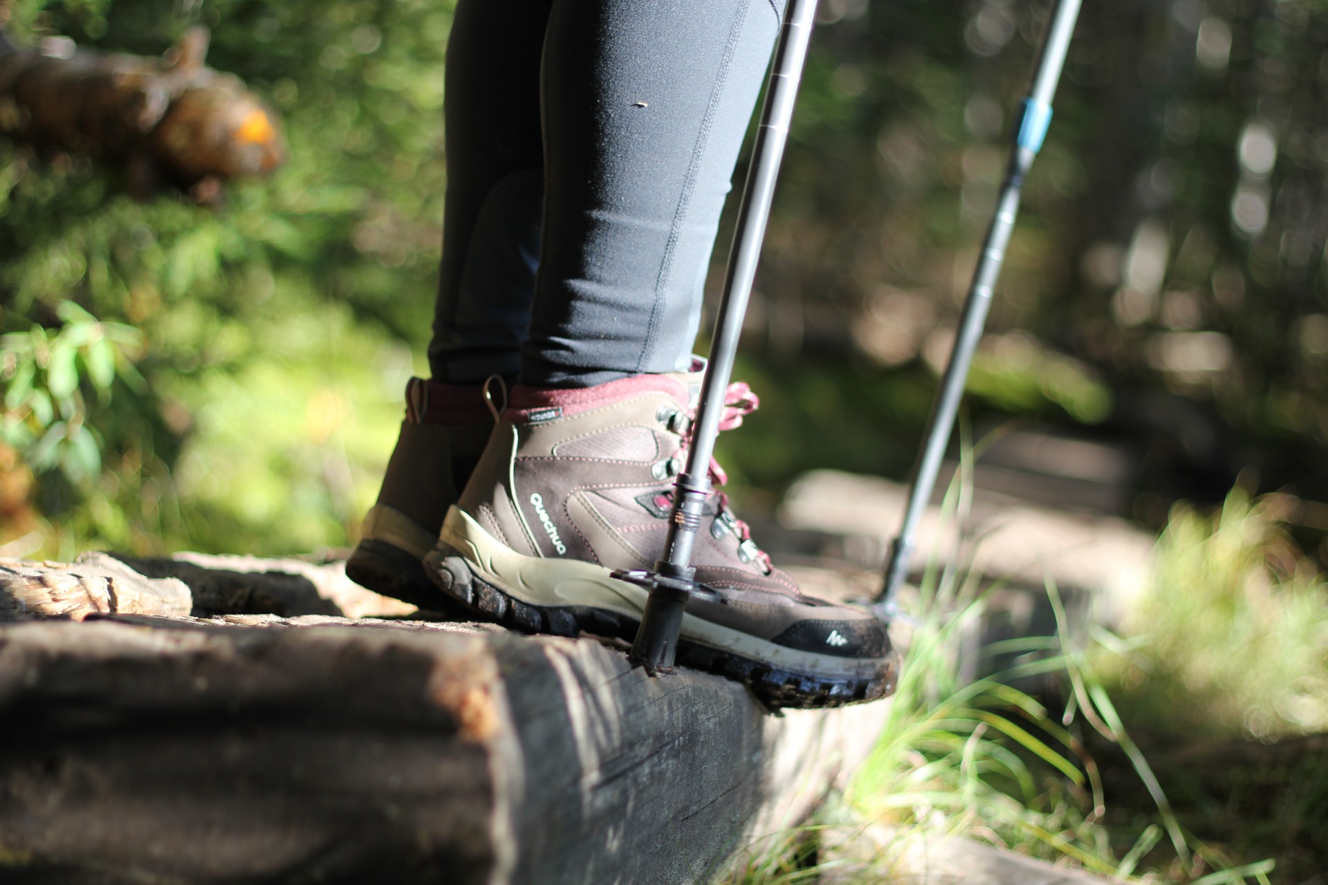
Hiking poles
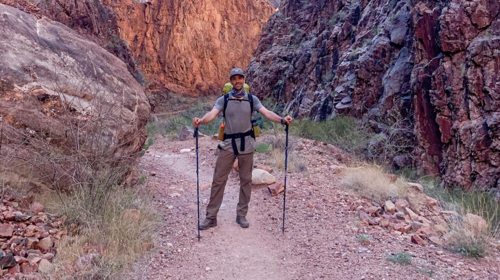
For the big elevation gain of the Rae Lakes Loop poles make a huge difference! I resisted getting them for years, but take it from a former skeptic, poles are incredible at reducing the strain of long, grueling descents and providing extra stability on exposed sections. Do yourself a favor and get a pair of poles. Leki makes some the best trekking poles on the market, I bought the Leki Micro Vario several years back and have no regrets. If you’re looking for a premium pole check out their new version the MCT Vario.
Bear canister
Bear canisters are required on the Rae Lakes Loop and Rangers will check for them. BearVault canisters are best for their transparent design that allows you to see inside. For several people go with the BV500 for solo adventures the BV450 works great.
Headlamp
The Spot 350 has 6 modes including the night vision saving red light. Red light mode takes a minute to get used to, but once you do it’s a total game changer trust me! Hello stars!!
GPS, compass & map
Download the GAIA app for maps and gps. I always bring a traditional compass and map as well in the case of technical problems or dead batteries.
Battery Back-up & Charging Cable
Keep your phone charged for photos and gps. View options at REI.
Luxury Items (Very Optional)
These items are extreme luxuries, but may be worth it depending on your weight priorities and the distance you plan to cover. I’d only consider these items on a low distance or base camp style hikes given their added weight and bulk.
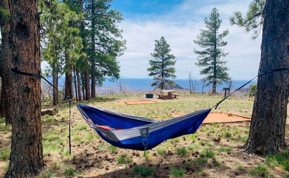
Hammock
If you’ve never strung up a hammock between two trees deep in the backcountry, you’re missing out! Nothing beats getting horizontal with some great reading material in the pre-dinner hours or taking in an amazing sunset from your own outdoor couch. The ENO Double Nest has room for two and at ½ kg the weight can be justified on certain trips.
Don’t forget the straps are sold separately (view them at Backcountry / REI).
Camp Chair
After a long day on the trail there’s nothing better than finding a nice comfortable spot to rest your weary glutes. The Helinox Chair Zero is a great option and at just over 1lb, it’s light enough to justify bringing on slower/easier backpacking trips where weight isn’t as big of consideration or for trips from an established base camp.
Clothing & Accessories
Shell jacket
An essential piece for wind, rain, and snow. The Arc’teryx Beta shell is the best all around shell jacket. This shell performs in all adverse conditions and is the perfect outer layer for cool Sierra nights or stormy afternoons. Arc’teryx gear is expensive, but impeccably designed. I was skeptical for years, until I purchased a few pieces of their trail running gear and got hooked. If you’re looking for the best reviewed hiking shell out there, this is the one.
For another excellent option that is more economical, check out the Patagonia Torrentshell 3L.
Puff jacket
I’ve had the Patagonia Nano Puff Hoody for years and it works great on it’s own or underneath a shell for extra warmth. It’s a perfect multi-functional item for everyday, backpacking, and pretty much anything where you might need a bit of warmth. I’m still looking for an activity it doesn’t work for.
Rainpants
Mountain weather can change fast and rain pants can be a lifesaver in your backpacking kit. Many have the functionality for quickly taking them on and off without removing your shoes/boots allowing you to stay comfortable even if you get caught in a sudden downpour. I’ve been happy with the Black Diamond StormLine Rain Pants.
Alternatively, check out the Patagonia Torrentshell Rainpants.
For a budget backup option REI branded rain pants are a great choice as well.
Sun hoodie
When I went backpacking in the Grand Canyon a few years back, I was shocked to see throngs of Arizona Trail thru-hikers wearing hoodies in the 100 degree (40 C) heat. Turns out they weren’t just lost tech bros in the Grand Canyon, they were really onto something! A sun hoodie has been one of the best items I’ve added to my backpacking kit. They keep you burn free, are surprisingly cool, and let you get away with leaving the bottle of sunscreen at home (or bringing way less). The Sahara Sun Hoodie from REI is one of the best items I’ve added to my backpacking wardrobe and you can’t beat the price.
Convertible hiking pants
I never thought I’d see the day I embraced the zip-off. But they really are the best of both worlds and can’t be beat for quick changing mountain weather. Check out the Patagonia Quandary Pant.
They are also available in a women’s version.
A pair of shorts
In addition to hiking pants, it’s nice to have a pair of shorts to change into after a long day on the trail or as a backup option. Trail running shorts are light and comfortable.
Base layer top
In addition to a sun hoodie, I also bring one base layer top to change into at camp or have as an alternate. The Capilene Cool trail t-shirts work great for me on long hikes and trail runs, but pretty much any athletic quick-dry top will work fine.
Base Layer Bottom
A merino bottom baselayer is perfect for warming up at night or during chilly mornings.
Underwear
I’ve had the best luck with these Patagonia underwear for hiking, trail running, mountain biking and skiing and found them to be more durable than the more expensive ones from lululemon. I usually bring a 2-3 pair depending on trip length.
They also make women’s underwear, but I am unable to advise on fit, form, function, or durability on this front. Check them out for yourself at Backcountry/Patagonia.
Hiking socks 3 pairs
I typically bring 3 pairs of socks. 1 pair for hiking, 1 pair to change into at camp, and a reserve to throw into the rotation as needed. Darn Tough Vermont makes the best hiking socks hands down. They’re guaranteed for life/replaced free of charge and they don’t stink. So go ahead and try to get holes in your socks. Really!
Sun hat & beanie
A ball cap or tilley hat keeps your face protected from the intense mountain sun. Check out these options at REI / Patagonia/Backcountry.
A winter hat or beanie is great for warming up during chilly mornings or evenings.
Sunglasses
Don’t forget to pack your favorite pair, the sun gets intense at these elevations!
Gloves
I typically bring a thin weatherproof pair of trail running gloves. The Black Diamond Mount Blanc have worked well for me.
Trail runners or hiking boots
Unless you’re hiking in the winter with the potential for snow and cold or you’re carrying the gear for your whole family, I’d choose trail runners for this hike. I’ve had great luck with the La Sportiva Bushido II.
The Altra Lone Peak are also a thru-hiker favorite and award winning trail shoe!
I do have a larger more traditional hiking boot, the Scarpa Kailash that I occasionally use when I’m carrying more gear/weight or heading somewhere with lots of snow. I typically prefer trail runners now, but these are still a great boot.
Camp shoes
Crocs are back! Well for backpacking camp shoes they never left… They’re lightweight and ugly as ever. Many backpackers find them to be the perfect camp shoe for resting sore feat after a long day in boots/shoes.
Low gaiters
Low gaiters are perfect for keeping rocks, sand, and snow out of your trail runners and saving you from blisters.
Additional Items to Pack
Microspikes (Season Dependent)
Kahtoola Microspikes slip effortlessly over your boots and make walking on snow and ice a breeze. If you’re tackling this hike early in the season there will be snow on Glen Pass. Bring these! Check price at Backcountry / REI.
Don't forget your wilderness permit
After picking up your permit from Road’s End Ranger Station remember to bring it along. You’ll be asked for it if you come across a ranger.
America the Beautiful Pass
Buy an America the Beautiful Annual Pass in advance if you plan on visiting multiple parks or visiting multiple times within a year of purchasing it. Sequoia and Kings Canyon charge $35 per vehicle for a 7 day pass, so it doesn’t take many visits to National Parks or any public lands to pay back the $80 dollar cost.
If this is the only time you’ll be visiting a National Park this year, you can also pre-purchase your 7 day entrance fee at recreation.gov.
Tooth brush & toothpaste
I recently started packing these toothpaste tabs in a tiny plastic bag/ziplock to save more space.
Duct tape (for repairs and blisters)
Food
Everyone has different takes and caloric requirements, so I’m not going to tell you exactly what to bring. I generally avoid the just add water meals you find at REI. They’re overpriced and often don’t rehydrate as you’d like. Check out these incredible soups and chilis they taste better, are made with better ingredients, and are less expensive. As another option, I head to the grocery store and search for things like lentil rice, ramen, or plant-based mac & cheese. They’re basically just add/boil quickly meals and taste like real food. Always rebag/repack this type of food as there is no reason to carry unnecessary packaging on the trail.
If you're coming from outside the US, don't forget this!
If you’re traveling from outside the US don’t forget to purchase comprehensive travel insurance that includes emergency evacuation.
Check out World Nomads* for a quote. Hopefully, you never need to make a claim, but if you do you’ll be beyond happy you were prepared! I broke my collarbone traveling a few years ago, which hurt enough! I can’t imagine how much worse it would have hurt if I had to pay the $15,000 in medical bills out-of-pocket…
Final thoughts on hiking the Rae Lakes Loop
- The Rae Lakes Loop was an absolutely spectacular backpacking trip.
- Completing it in 3 days was manageable, but day 1 was long.
- Would love to return to check out the Sixty Lakes Basin or Gardiner Basin areas.
- JMT and PCT section from Woods Creek Bridge to Lower Vidette Meadow felt very busy due to thru hiker traffic.
- Bugs were pretty bad at times in early June. Saw hikers with face nets.
Your Thoughts on Rae Lakes
Have you hiked the Rae Lakes Loop? I’d love to hear from you. Questions about backpacking Rae Lakes? Drop me a line in the comments below and I’ll do my best to help!
More adventures you might enjoy
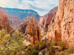
Grand Canyon Backpacking | Ultimate Rim to Rim to Rim Guide
Backpacking the Grand Canyon from rim to rim to rim is the perfect adventure to get introduced to this natural wonder of the world. We’ve put together the ultimate guide to help you make it happen.
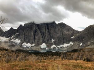
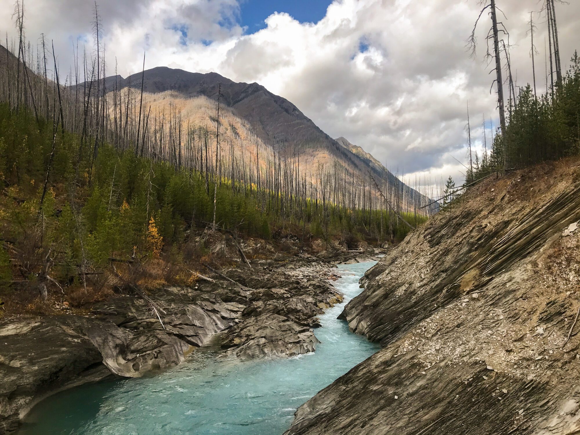
Rockwall Trail | The Ultimate Guide to Hiking the Rockwall
The Rockwall Trail is one of the Canadian Rockies’ premier backpacking trips. For 55km you’ll be treated to a seemingly unending supply of sublime Rocky Mountain scenery. Here’s how to make it happen with must-read tips for getting a permit and beating the crowds.
Michael


 ?
?